Near Fairfax in Fairfax County, Virginia — The American South (Mid-Atlantic)
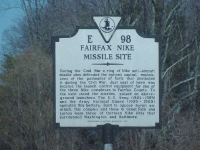
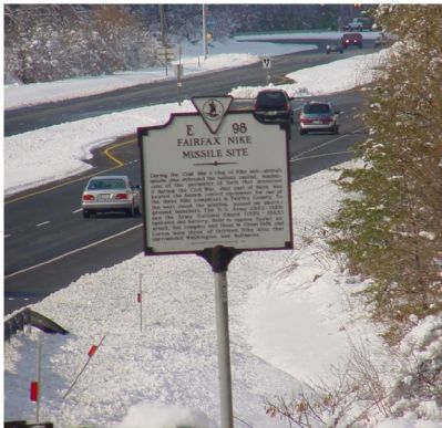
Fairfax Nike Missile Site
Erected 1994 by Department of Historic Resources. (Marker Number E-98.)
Topics. This historical marker is listed in these topic lists: Air & Space • War, Cold.
Location. 38° 48.98′ N, 77° 20.764′ W. Marker is near Fairfax, Virginia, in Fairfax County. Marker is on Fairfax County Parkway (County Route 7100) south of Popes Head Road (County Route 654), on the right when traveling north. Touch for map. Marker is in this post office area: Fairfax VA 22030, United States of America. Touch for directions.
Other nearby markers. At least 8 other markers are within 2 miles of this marker, measured as the crow flies. Payneís Church (approx. 1.1 miles away); The Legend Story of the First Prayer Wheel / Prayer for World Peace and Welfare (approx. 1.3 miles away); World Peace Sand Mandala (approx. 1.3 miles away); Railroad Motorcar (approx. 1.3 miles away); Hogshead (approx. 1.3 miles away); Type C31 (Cupola) Caboose (approx. 1.3 miles away); Fairfax Station (approx. 1.4 miles away); Welcome to Fairfax Station (approx. 1.4 miles away). Touch for a list and map of all markers in Fairfax.
Related markers. Click here for a list of markers that are related to this marker.
Also see . . .
1. Areal View of Fairfax Site Control Facilties. (Submitted on July 11, 2007, by Craig Swain of Leesburg, Virginia.)
2. Answer Man Fires Off A Bit of Cold War History. From a Washington Post article, published Sunday, November 26, 2006: “ The Army left the Popes Head site in 1961. Fairfax County paid $108,700 for the land in 1984 and demolished the buildings soon after. Today, part of the site is a public works storage yard and part is a park. No traces remain of its former purpose.” (Submitted on September 4, 2007, by Kevin W. of Stafford, Virginia.)
3. Nike Related Manuals, Books, Articles. (Submitted on February 12, 2006.)
Additional commentary.
1. Site ID W-74
According to "Rings of Supersonic Steel" by Mark L. Morgan and Mark A. Berhow, the Fairfax site was designated W-74. The facilities were apparently transfered over to Fairfax County and used for maintenance facilities. Based on the location descriptions (South of Popes Head Road) some of the structures may be in Popes Head Stream Valley Park.
— Submitted July 3, 2007, by Craig Swain of Leesburg, Virginia.
Credits. This page was last revised on July 14, 2019. It was originally submitted on February 12, 2006, by J. J. Prats of Powell, Ohio. This page has been viewed 21,218 times since then and 279 times this year. Last updated on August 15, 2007, by Craig Swain of Leesburg, Virginia. Photos: 1. submitted on February 16, 2006, by J. J. Prats of Powell, Ohio. 2, 3. submitted on February 12, 2006, by J. J. Prats of Powell, Ohio.


