Buckhead in Atlanta in Fulton County, Georgia — The American South (South Atlantic)
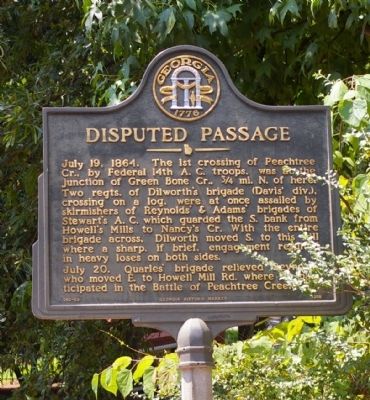
Disputed Passage
July 19, 1864. The 1st crossing of Peachtree Cr., by Federal 14th A.C. troops, was at the junction of Green Bone Cr., 3/4 mi. N. of here. Two regts. of Dilworth’s brigades (Davis' div.), crossing on a log, were at once assailed by skirmishers of Reynolds’ & Adams’ brigades of Stewart’s A.C. which guarded the S. bank from Howell’s Mills to Nancy’s Cr. With the entire brigade across, Dilworth moved S. to this hill where a sharp, if brief, engagement resulted in heavy loses on both sides.
July 20. Quarles’ brigade relieved Reynolds, who moved E. on Howell Mill Rd. where he participated in the Battle of Peachtree Creek.
Erected 1988 by Georgia Department of Natural Resources. (Marker Number 060-66.)
Topics and series. This historical marker is listed in this topic list: War, US Civil. In addition, it is included in the Georgia Historical Society series list. A significant historical date for this entry is July 19, 1777.
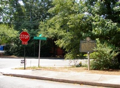
Location. 33° 48.856′ N, 84° 25.633′ W. Marker is in Atlanta, Georgia, in Fulton County. It is in Buckhead. Marker is at the intersection of Bohler Road and DeFoors Ferry Road, on the left when traveling north on Bohler Road. Touch for map. Marker is in this post office area: Atlanta GA 30318, United States of America. Touch for directions.
Other nearby markers. At least 8 other markers are within walking distance of this marker . Rt. Of 20th A.C. Line (approx. 0.7 miles away); French’s Division Hood’s Left Flank (approx. 0.8 miles away); French's Line (approx. 0.8 miles away); Old Mt. Zion Church (approx. 0.9 miles away); Maj. William C. Preston C.S.A (approx. 0.9 miles away); Federal Crossings (approx. 0.9 miles away); Reynold’s Brigade (approx. 0.9 miles away); Howell's Mills (approx. 0.9 miles away). Touch for a list and map of all markers in Atlanta.
More about this marker. This marker replaced an earlier marker of the same title and text on this location erected by the Georgia Historical Commission.
Credits. This page was last revised on February 8, 2023. It was originally submitted on August 9, 2009, by David Seibert of Sandy Springs, Georgia. This page has been viewed 1,114 times since then and 18 times this year. Photos: 1, 2. submitted on August 9, 2009, by David Seibert of Sandy Springs, Georgia. • Craig Swain was the editor who published this page.

