Sunset Hill in Kansas City in Jackson County, Missouri — The American Midwest (Upper Plains)
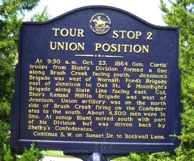
Union Position
Continue S.W. on Sunset Dr. to Rockwell Lane. (Marker Number 2.)
Topics and series. This historical marker is listed in this topic list: War, US Civil. In addition, it is included in the Missouri – Battle of Westport series list. A significant historical year for this entry is 1864.
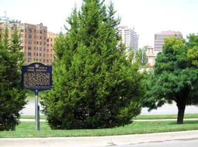
Location. 39° 2.344′ N, 94° 35.693′ W. Marker is in Kansas City, Missouri, in Jackson County. It is in Sunset Hill. Marker is on Sunset Drive, 0.1 miles west of Ward Parkway, on the right when traveling west. This marker is between two very large cedar trees and is very hard to spot. The marker is between Ward Parkway and 49th Street, which is the next crossroad. Touch for map. Marker is in this post office area: Kansas City MO 64112, United States of America. Touch for directions.
Other nearby markers. At least 8 other markers are within walking distance of this marker. Landing At Westport (approx. 0.2 miles away); Battle of Westport (approx. ¼ mile away); Confederate Position (approx. ¼ mile away); Wild Boar of Florence (approx. 0.3 miles away); Aleman Court (approx. 0.3 miles away); Neptune (approx. 0.3 miles away); Union Artillery (approx. 0.3 miles away); First Home of the Kansas City Country Club (approx. 0.4 miles away). Touch for a list and map of all markers in Kansas City.
Also see . . . Battle of Westport. (Submitted on August 17, 2009, by Thomas Onions of Olathe, Kansas.)
Credits. This page was last revised on February 10, 2023. It was originally submitted on August 17, 2009, by Thomas Onions of Olathe, Kansas. This page has been viewed 1,057 times since then and 19 times this year. Photos: 1, 2. submitted on August 17, 2009, by Thomas Onions of Olathe, Kansas. • Craig Swain was the editor who published this page.

