Winchester, Virginia — The American South (Mid-Atlantic)
The First Battle of Kernstown
An Unheralded Commander’s Unique Victory
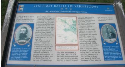
Photographed By Craig Swain, August 25, 2007
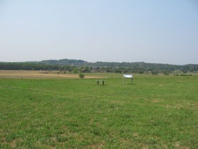
1. The First Battle of Kernstown Marker
A Virtual Tour of the Kearnstown Battles by HMDb markers:
Click for more information.
Click for more information.
At 9:00 A.M. on March 23, 1862, Confederate artillery unlimbered near the Valley Turnpike and fired on this height, called Pritchard’s Hill, to begin the First Battle of Kernstown. Union artillery rolled onto these knolls and responded by discharging 700 rounds of shot and shell over the next five hours. More than 300 Union soldiers crowded the height to protect the artillery while Colonel Nathan Kimball, the Union battlefield commander, set up headquarters on this same hill.
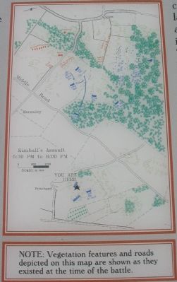
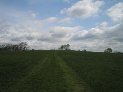
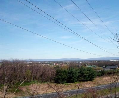
Kimball successfully repulsed Confederate infantry in its attempt to dislodge the artillery from this ground early in the afternoon, only to watch helplessly as General Jackson swiftly shifted his Confederate artillery from the Valley Turnpike to the crest of Sandy Ridge (the ridge line one mile to your right). By 3:30 P.M. Jackson’s cannon suppressed the Union artillery position. Perched on this hill, Kimball countered aggressively by launching two infantry attacks in quick succession in a effort to force “Stonewall” Jackson from his commanding position.
By sunset, Kimball’s assaults dislodged Jackson’s troops from Sandy Ridge, capturing two cannon and 250 healthy soldiers. The Confederates also suffered 450 killed within their ranks from the day-log battle. Colonel Kimball’s men killed and wounded numbered nearly 600 for the day. His victory earned him a promotion to the rank of brigadier general. Kimball, an Indiana physician before the war, became the only field commander in the Civil War to defeat both Robert E. Lee (Cheat Mountain in West Virginia) and “Stonewall” Jackson (Kernstown) in separate engagements.
(Left Sidebar, with portrait of Colonel Nathan Kimball): Colonel Nathan Kimball’s solid leadership at Kernstown was repeated in later Civil War campaigns. Breveted Major General in 1865, Kimball retired from the army after participating in 22 victories against three losses.
(Right Sidebar, with portrait of Colonel William Murray): Colonel William Murray spent most of the Kernstown battle on this knoll with his 84th Pennsylvania Infantry until ordered to charge the Confederate cannon on Sandy Ridge late in the afternoon. Murray was killed 40 yards from the Southern artillery, the highest ranking officer to die on March 23, 1862.
Erected by Shenandoah Valley Battlefields National Historic District.
Topics. This historical marker is listed in this topic list: War, US Civil. A significant historical month for this entry is March 1912.
Location. This marker has been replaced by another marker nearby. It was located near 39° 8.716′ N, 78° 11.729′ W. Marker was in Winchester, Virginia. Marker could be reached from Battle Park Drive, on the right when traveling west. Located in the Pritchard-Grim Farm, Kernstown Battlefield, on Pritchard Hill. Touch for map. Marker was at or near this postal address: 610 Battle Park Drive, Winchester VA 22604, United States of America. Touch for directions.
Other nearby markers. At least 8 other markers are within walking distance of this location. Second Battle of Winchester (about 500 feet away, measured in a direct line); The Second Battle of Kernstown (about 500 feet away); a different marker also named The First Battle of Kernstown (about 500 feet away); The Pritchard House (about 800 feet away); a different marker also named The First Battle of Kernstown (approx. 0.2 miles away); a different marker also named The Second Battle of Kernstown (approx. 0.2 miles away); a different marker also named Second Battle of Kernstown (approx. 0.2 miles away); Kernstown Battlefield (approx. 0.2 miles away). Touch for a list and map of all markers in Winchester.
More about this marker. The marker also has a map detailing the tactical situation and movements.
Related marker. Click here for another marker that is related to this marker. This marker has been replaced by the linked marker.
Also see . . .
1. Kernstown Battlefield Association. Association website homepage (Submitted on August 29, 2007, by Craig Swain of Leesburg, Virginia.)
2. First Battle of Kernstown. National Parks Service website entry (Submitted on August 29, 2007, by Craig Swain of Leesburg, Virginia.)
3. General Nathan Kimball, USA. History Central website entry (Submitted on August 29, 2007, by Craig Swain of Leesburg, Virginia.)
Credits. This page was last revised on July 24, 2022. It was originally submitted on August 29, 2007, by Craig Swain of Leesburg, Virginia. This page has been viewed 2,310 times since then and 27 times this year. Photos: 1, 2, 3. submitted on August 29, 2007, by Craig Swain of Leesburg, Virginia. 4. submitted on November 26, 2010, by Bill Coughlin of Woodland Park, New Jersey. 5. submitted on April 18, 2009. • J. J. Prats was the editor who published this page.
