Woodbridge in Prince William County, Virginia — The American South (Mid-Atlantic)
Fairfax County / Prince William County
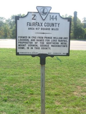
Fairfax County. Area 417 Square Miles. Formed in 1742 from Prince William and Loudoun, and named for Lord Fairfax, proprietor of the Northern Neck. Mount Vernon, George Washington’s home, is in this county.
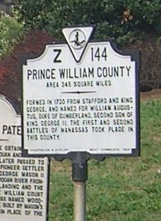
Prince William County. Area 345 Square Miles. Formed in 1730 from Stafford and King George, and named for William Augustus, Duke of Cumberland, second son of King George II. The first and second battles of Manassas took place in this county.
Erected 1934 by Conservation and Development Commission. (Marker Number Z-144.)
Topics and series. This historical marker is listed in these topic lists: Colonial Era • Settlements & Settlers • War, US Civil. In addition, it is included in the Virginia Department of Historic Resources (DHR) series list. A significant historical year for this entry is 1742.
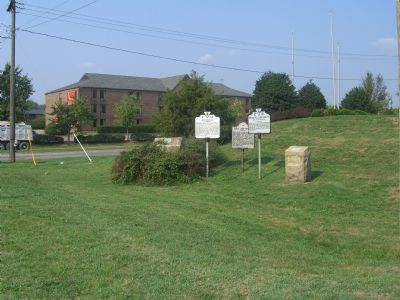
Location. Marker has been permanently removed. It was located near 38° 39.926′ N, 77° 14.635′ W. Marker was in Woodbridge, Virginia, in Prince William County. Marker was at the intersection of Richmond Highway (U.S. 1) and Annapolis Way, on the right when traveling south on Richmond Highway. Touch for map. Marker was at or near this postal address: 951 Annapolis Way, Woodbridge VA 22191, United States of America.
We have been informed that this sign or monument is no longer there and will not be replaced. This page is an archival view of what was.
Other nearby markers. At least 8 other markers are within 2 miles of this location, measured as the crow flies. A Near Tragedy (about 700 feet away, measured in a direct line); Colchester (approx. half a mile away); End of the Water (approx. 0.8 miles away); Welcome to Occoquan Bay National Wildlife Refuge (approx. 1.1 miles away); A Corridor and a Barrier (approx. 1.1 miles away); The Trail to Victory at Yorktown (approx. 1.2 miles away); Welcome to Colchester on the Occoquan (approx. 1.2 miles away); Revolutionary Army Life on the Road (approx. 1.2 miles away). Touch for a list and map of all markers in Woodbridge.
Credits. This page was last revised on May 24, 2023. It was originally submitted on September 6, 2007, by Kevin W. of Stafford, Virginia. This page has been viewed 1,326 times since then and 7 times this year. Photos: 1, 2, 3. submitted on September 6, 2007, by Kevin W. of Stafford, Virginia. • J. J. Prats was the editor who published this page.


