Near Scituate in Plymouth County, Massachusetts — The American Northeast (New England)
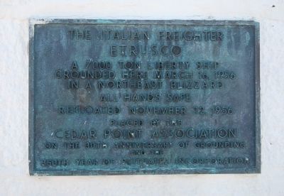
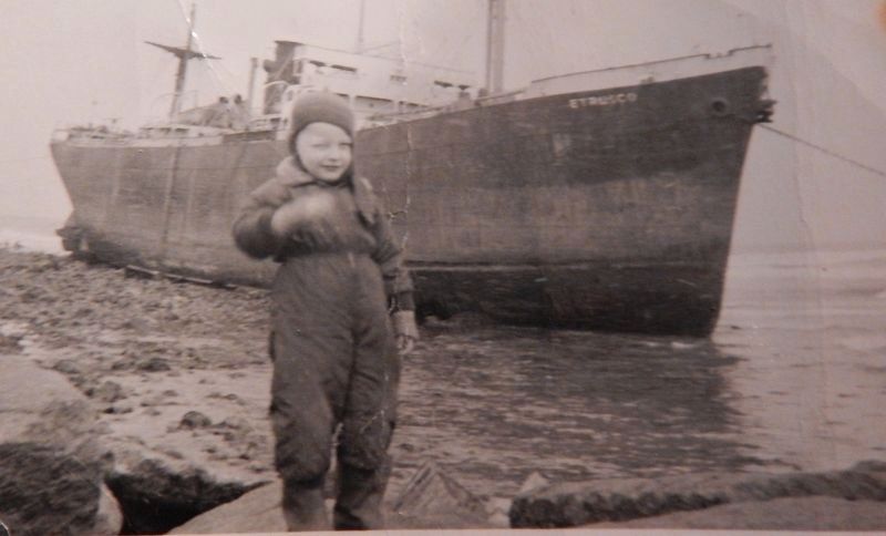
The Italian Freighter Etrusco
Placed by the Cedar Point Association on the 30th anniversary of grounding and the 350th year of Scituate's incorporation.
Erected 1986 by the Cedar Point Association.
Topics. This historical marker is listed in these topic lists: Landmarks • Notable Events • Waterways & Vessels. A significant historical date for this entry is March 16, 1956.
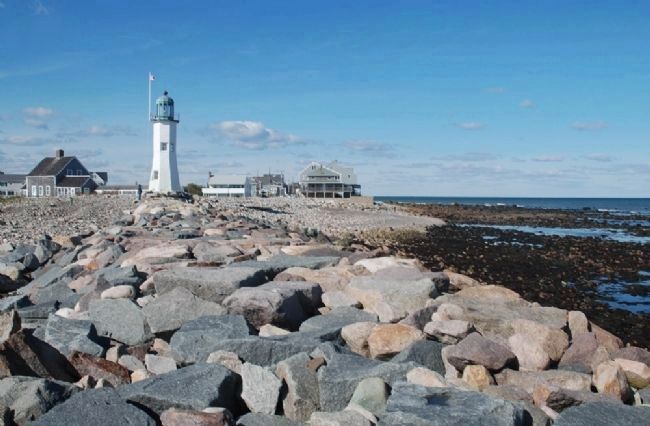
Location. 42° 12.286′ N, 70° 42.949′ W. Marker is near Scituate, Massachusetts, in Plymouth County. Marker can be reached from Lighthouse Road. Marker is mounted on the northeast side of the Old Scituate Lighthouse, located at Cedar Point, on the north side of the entrance to Scituate harbor and 20 miles southeast of Boston, Massachusetts. Touch for map. Marker is in this post office area: Scituate MA 02066, United States of America. Touch for directions.
Other nearby markers. At least 8 other markers are within 2 miles of this marker, measured as the crow flies. “Don’t Give Up The Ship” (here, next to this marker); Old Scituate Lighthouse (within shouting distance of this marker); Williams-Barker House (approx. 0.6 miles away); Satuit Brook (approx. one mile away); Men of Kent Cemetery (approx. 1.3 miles away); First Meeting House (approx. 1.3 miles away); Site of the First Church (approx. 1.3 miles away); First Training Field (approx. 1.4 miles away). Touch for a list and map of all markers in Scituate.
Additional keywords. shipwreck The Italian Freighter Etrusco
Credits. This page was last revised on November 2, 2020. It was originally submitted on October 20, 2009, by Roger W. Sinnott of Chelmsford, Massachusetts. This page has been viewed 2,797 times since then and 86 times this year. Photos: 1. submitted on October 20, 2009, by Roger W. Sinnott of Chelmsford, Massachusetts. 2. submitted on July 3, 2017, by Richard Drake of Plymouth, Massachusetts. 3. submitted on October 20, 2009, by Roger W. Sinnott of Chelmsford, Massachusetts. • Kevin W. was the editor who published this page.


