Near Polkville in Cleveland County, North Carolina — The American South (South Atlantic)
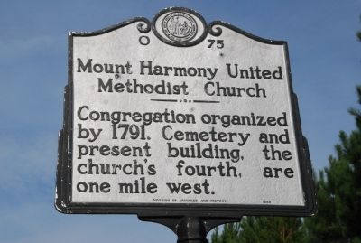
Mount Harmony United Methodist Church
Erected 1988 by Division of Archives and History. (Marker Number O-75.)
Topics and series. This historical marker is listed in these topic lists: Cemeteries & Burial Sites • Churches & Religion • Colonial Era. In addition, it is included in the North Carolina Division of Archives and History series list. A significant historical year for this entry is 1791.
Location. 35° 27.882′ N, 81° 40.404′ W. Marker is near Polkville, North Carolina, in Cleveland County. Marker is at the intersection of Polkville Road (State Highway 226) and Mt. Harmony Church Road (County Road 1379), on the right when traveling north on Polkville Road. Touch for map. Marker is in this post office area: Lawndale NC 28090, United States of America. Touch for directions.
Other nearby markers. At least 8 other markers are within 14 miles of this marker, measured as the crow flies. Metcalfe Station (approx. 9.3 miles away); Fallston Veterans Memorial (approx. 9.9 miles away); The N.C. Lincoln Birth Story (approx. 11.6 miles away); Cane Creek (approx. 12.1 miles away); W. J. Cash (approx. 13.9 miles away); O. Max Gardner (approx. 13.9 miles away); Thomas Dixon, Jr. (approx. 13.9 miles away); Elisha Baxter (approx. 14 miles away).
Additional commentary.
1. Mt. Harmony Methodist Church from North Carolina Highway Historical Marker Program site
Over the years conflicting claims has surfaced regarding which Methodist church was the first to be established west of the Catawba River. Methodist historian Elmer T. Clark took note of the disagreements in his 1966 book Methodism in Western North Carolina. Years earlier Rehobeth Methodist Church in Catawba County had erected a marker claiming the distinction. Yet, Clark asserted, comparison of the date on the Rehobeth deed (November 29, 1792) with the date on the deed for Mount Harmony Church in northwest Cleveland County (June 25, 1791) placed the claim in question.
Mount Harmony and Rehobeth do share an association with Daniel Asbury (1762-1825). Asbury, not related to Bishop Francis Asbury, was an itinerant Methodist minister and church leader. Born in Virginia, he came to North Carolina in 1787. He married in Lincoln County (the section of which later formed Catawba County) and generally preached on circuits in that region. He was personally responsible for establishing numerous churches aside from Mount Harmony and Rehobeth, where he is buried.
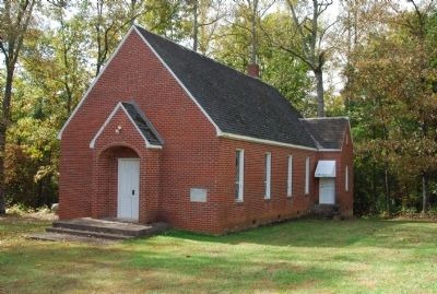
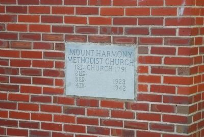
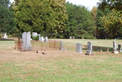
Asbury was named as one of several grantees in the 1791 deed conveying two and one-half acres to the Mount Harmony congregation. The first church building was already in place when the deed was executed. A second structure, a log building with a balcony for slaves, was probably built in the early nineteenth century. It stood until about 1922, when it was replaced with a frame building. The third building burned in 1942 and was replaced with the present brick structure. Meetings of the congregation apparently have been held continuously since 1791. The church lot was enlarged in 1827 and 1967, and is now four acres in size. The cemetery, adjacent to the sanctuary, holds white and slave burials.
— Submitted October 22, 2009, by Michael Sean Nix of Spartanburg, South Carolina.
Photographed By Michael Sean Nix, October 22, 2009
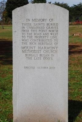
5. Mount Harmony United Methodist Church Cemetery
In memory of those saints buried in unmarked graves from this point north to the road and west to the property line who contributed to the rich heritage of Mount Harmony Methodist Church. Burials began in the late 1700's.
Erected 2001
Credits. This page was last revised on June 16, 2016. It was originally submitted on October 22, 2009, by Michael Sean Nix of Spartanburg, South Carolina. This page has been viewed 1,625 times since then and 62 times this year. Photos: 1, 2, 3, 4, 5. submitted on October 22, 2009, by Michael Sean Nix of Spartanburg, South Carolina. • Kevin W. was the editor who published this page.
