Portage in Columbia County, Wisconsin — The American Midwest (Great Lakes)
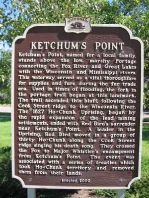
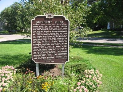
Ketchum’s Point
Erected 2000 by the Wisconsin Historical Society. (Marker Number 451.)
Topics and series. This historical marker is listed in these topic lists: Wars, US Indian • Waterways & Vessels. In addition, it is included in the Wisconsin Historical Society series list. A significant historical year for this entry is 1827.
Location. 43° 32.69′ N, 89° 26.937′ W. Marker is in Portage , Wisconsin, in Columbia County. Marker is at the intersection of State Highway 33 and East Cook Street, on the right when traveling east on State Highway 33. Marker is 0.7 miles east of State Route 16. Touch for map. Marker is in this post office area: Portage WI 53901, United States of America. Touch for directions.
Other nearby markers. At least 8 other markers are within one mile of this marker, measured as the crow flies. Jacques Marquette and Louis Joliet (approx. 0.7 miles away); Zona Gale (approx. ¾ mile away); Frederick Jackson Turner (approx. ¾ mile away); Society Hill Historic District (approx. 0.8 miles away); Trinity United Church of Christ (approx. one mile away); Marquette (approx. one mile away); Fort Winnebago (approx. one mile away); Site of Fort Winnebago (approx. one mile away). Touch for a list and map of all markers in Portage.
Regarding Ketchum’s Point. Ho-Chunk (or Winnebago, a branch of the Sioux), as they prefer to be called today, means “People of the Big Voice.”
Also see . . . Winnebago War. "On June 27, 1827, a band of Winnebago led by a war chief named Red Bird and a Prophet called White Cloud entered Prairie du Chien seeking revenge for what they believed were the executions of the Winnebago prisoners by the U.S. Army." (Submitted on September 10, 2007, by Keith L of Wisconsin Rapids, Wisconsin.)
Credits. This page was last revised on June 16, 2016. It was originally submitted on September 10, 2007, by Keith L of Wisconsin Rapids, Wisconsin. This page has been viewed 2,652 times since then and 56 times this year. Photos: 1, 2. submitted on September 10, 2007, by Keith L of Wisconsin Rapids, Wisconsin. • J. J. Prats was the editor who published this page.

