Near Williamsburg in James City County, Virginia — The American South (Mid-Atlantic)
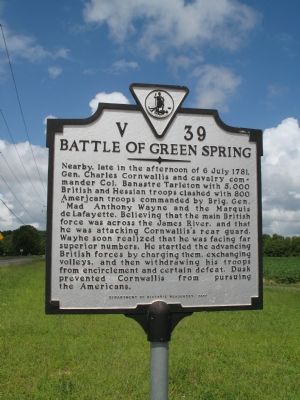
Battle Of Green Spring
Erected 2000 by Department of Historic Resources. (Marker Number V-39.)
Topics and series. This historical marker is listed in this topic list: War, US Revolutionary. In addition, it is included in the Virginia Department of Historic Resources (DHR) series list. A significant historical year for this entry is 1781.
Location. 37° 14.105′ N, 76° 47.108′ W. Marker is near Williamsburg, Virginia, in James City County. Marker is on Greensprings Road (County Route 614) north of 4H Club Road, on the right when traveling north. Touch for map. Marker is at or near this postal address: 2592 Greensprings Rd, Jamestown VA 23081, United States of America. Touch for directions.
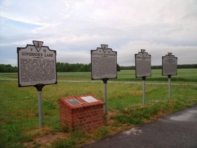
Other nearby markers. At least 8 other markers are within walking distance of this marker. Governor’s Land (here, next to this marker); Green Spring Road (here, next to this marker); Church on the Main (here, next to this marker); Battle of Green Spring (within shouting distance of this marker); Samuel H. Yonge, Civil Engineer (1843-1935) (approx. 0.4 miles away); Pocahontas (approx. 0.4 miles away); Jamestown Road (approx. half a mile away); First Germans at Jamestown (approx. half a mile away). Touch for a list and map of all markers in Williamsburg.
More about this marker. This marker sits with 3 other markers, V41,V42,V46 on the side of the road at a driveway entrance of some sort.
Credits. This page was last revised on April 3, 2022. It was originally submitted on September 11, 2007, by Laura Troy of Burke, Virginia. This page has been viewed 3,097 times since then and 40 times this year. Last updated on April 2, 2022, by Carl Gordon Moore Jr. of North East, Maryland. Photos: 1. submitted on September 11, 2007, by Laura Troy of Burke, Virginia. 2. submitted on May 12, 2010, by Bernard Fisher of Richmond, Virginia. • Bernard Fisher was the editor who published this page.

