Iguazú National Park in Iguazú, Misiones, Argentina — Southern South America
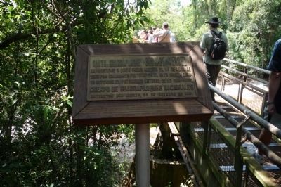
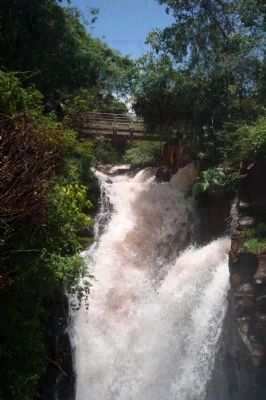
Bernabe Mendez Bridge
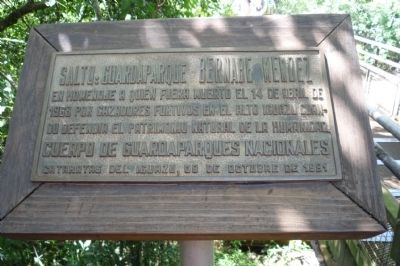
Salto: Guardaparque Bernabe Mendez
— Parque Nacional Iguazú —
En homenaje a quien fuera muerto el 14 de April de 1968 por cazadores furtivos en el Alto Iguazú cuando defendía el patrimonio natural de la humanidad.
Cuerpo de Guadaparques Nacionales, 09 de Octubre de 1991.
In honor of he who was killed on April 14, 1968, by stealthy poachers in Iguazu Heights while defending humanity’s natural heritage.
National Park Guard Corps, October 9, 1991.
Erected 1991 by Cuerpo de Guadaparques Nacionales.
Topics. This historical marker is listed in these topic lists: Law Enforcement • Waterways & Vessels. A significant historical date for this entry is October 9, 1991.
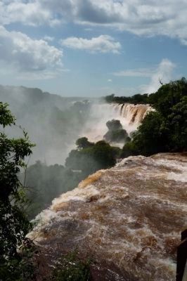
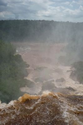
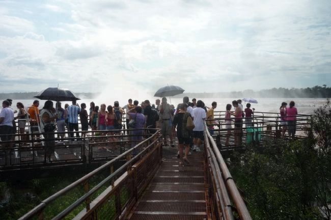
Location. 25° 41.187′ S, 54° 26.779′ W. Marker is in Iguazú National Park, Misiones, in Iguazú. Marker is on the Circuito Superior, 1.6 kilometers north of the Rainforest Ecological Railway. The marker is at the bridge (Salto Bernabe Mendez) on the upper circuit trail, north of the National Park’s main entrance—across the cataracts from Brazil. Touch for map. Marker is in this post office area: Iguazú National Park, Misiones 3370, Argentina. Touch for directions.
Other nearby markers. At least 2 other markers are within walking distance of this marker. Alvar Núñez Cabeza de Vaca (approx. 0.4 kilometers away); Alberto Santos-Dumont Memorial (approx. 1.3 kilometers away in Brazil).
More about this marker. The “nearby” markers in the Brazilian park are NOT “within walking distance” of those in the Argentine park—they are separated by the world’s biggest waterfall.
Also see . . . Iguazu Falls. ... Upon seeing Iguazu, the United States' First Lady Eleanor Roosevelt reportedly exclaimed "Poor Niagara!" Iguazu is also often compared with Southern Africa's Victoria Falls which separates Zambia and Zimbabwe. Iguazu is wider, but because it is split into about 270 discrete falls and large islands, Victoria is the largest curtain of water in the world, at over 1,600 m (5,249 ft) wide and over 100 m (328 ft) in height (in low flow Victoria is split into five by islands; in high flow it can be uninterrupted). The only wider falls are extremely large rapid-like falls such as the Boyoma Falls). With the flooding of the Guaíra Falls in 1982, Iguazu currently has the greatest average annual flow of any waterfall in the world. The water falling over Iguazu in peak flow has a surface area of about 40 Ha (1.3 million ft²) whilst Victoria in peak flow has a surface area of over 55 ha (1.8 million ft²). By comparison, Niagara has a surface area of under 18.3 ha (600,000 ft²). Victoria's annual peak flow is also greater than Iguazu's annual peak—9,100 m³/s versus 6,500—though in times of extreme flood the two have recorded very similar maximum water discharge (well in excess of 12,000 m³/s). Niagara's annual peak flow is about 2,800 m³/s, although an all-time peak of 6,800 has been recorded. Iguazu and Victoria fluctuate more greatly in their flow rate. Mist rises between 30 metres (98 ft) and 150 m (492 ft) from Iguazu's Devil's Throat, and over 300 m (984 ft) above Victoria. Iguazu, however, affords better views and walkways and its shape allows for spectacular vistas. At one point a person can stand and be surrounded by 260 degrees of waterfalls. The Devil's Throat has water pouring into it from three sides. Likewise, because Iguazu is split into many relatively small falls, one can view these a portion at a time. Victoria does not allow this, as it is essentially one waterfall that falls into a canyon and is too immense to appreciate at once (except from the air). ... (Submitted on January 7, 2010, by Richard E. Miller of Oxon Hill, Maryland.)
Additional keywords.
Park Ranger; law enforcement; "Wonders of the World"; UNESCO World Heritage Site.
Credits. This page was last revised on May 10, 2023. It was originally submitted on January 7, 2010, by Richard E. Miller of Oxon Hill, Maryland. This page has been viewed 2,846 times since then and 48 times this year. Photos: 1, 2, 3, 4, 5, 6. submitted on January 7, 2010, by Richard E. Miller of Oxon Hill, Maryland. • Bill Pfingsten was the editor who published this page.
