Near Winchester in Frederick County, Virginia — The American South (Mid-Atlantic)
Second Battle of Winchester
Inscription.
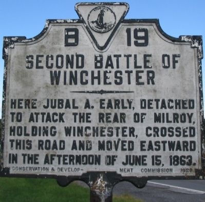
Here Jubal A. Early, detached to attack the rear of Milroy, holding Winchester, crossed this road and moved eastward in the afternoon of June 15, 1863.
Erected 1929 by Conservation & Development Commission. (Marker Number B-19.)
Topics and series. This historical marker is listed in this topic list: War, US Civil. In addition, it is included in the Virginia Department of Historic Resources (DHR) series list. A significant historical date for this entry is June 15, 1912.
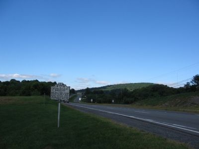
Location. 39° 11.505′ N, 78° 12.904′ W. Marker is near Winchester, Virginia, in Frederick County. Marker is on Northwestern Pike (U.S. 50), on the right when traveling east. Touch for map. Marker is in this post office area: Winchester VA 22601, United States of America. Touch for directions.
Other nearby markers. At least 8 other markers are within 3 miles of this marker, measured as the crow flies. Welcome to a Special Place (approx. 1.8 miles away); Glen Burnie (approx. 1.9 miles away); Birthplace of James Wood, Junior (approx. 2 miles away); Home of Colonel James Wood, Sr. (approx. 2 miles away); a different marker also named Second Battle of Winchester (approx. 2 miles away); a different marker also named Glen Burnie (approx. 2 miles away); Rear Admiral Richard E. Byrd (approx. 2.3 miles away); First Battle of Winchester (approx. 2.4 miles away). Touch for a list and map of all markers in Winchester.
Also see . . . Second Battle of Winchester. National Parks Service battle summary. The flank march is detailed in phase five. (Submitted on September 23, 2007, by Craig Swain of Leesburg, Virginia.)
Credits. This page was last revised on June 16, 2016. It was originally submitted on September 23, 2007, by Craig Swain of Leesburg, Virginia. This page has been viewed 1,441 times since then and 21 times this year. Photos: 1, 2, 3. submitted on September 23, 2007, by Craig Swain of Leesburg, Virginia. • J. J. Prats was the editor who published this page.


