Frederick in Frederick County, Maryland — The American Northeast (Mid-Atlantic)
Market & Patrick Streets
"Scarcely any possibility of crossing the street"
— Gettysburg Campaign —
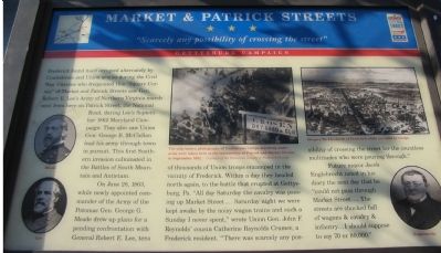
On June 28, 1863, while newly appointed commander of the Army of the Potomac Gen. George G. Meade drew up plans for a pending confrontation with General Robert E. Lee, tens of thousands of Union troops encamped in the vicinity of Frederick. Within a day they headed north again, to the battle that erupted at Gettysburg, Pa. "All day Saturday the cavalry was passing up Market Street.... Saturday night we were kept awake by the noisy wagon trains and such a Sunday I never spent," wrote Union Gen. John F. Reynolds' cousin Catherine Reynolds Cramer, a Frederick resident. "There was scarcely any possibility of crossing the street for the countless multitudes who were pouring through."
Future mayor Jacob Englebrecht noted in his diary the next day that he "could not pass through Market Street....The streets are chucked full of wagons & cavalry & infantry... I should supposed say 70 or 80,000."
Topics and series. This historical marker is listed in this topic list: War, US Civil. In addition, it is included in the Maryland Civil War Trails series list. A significant historical month for this entry is June 1862.
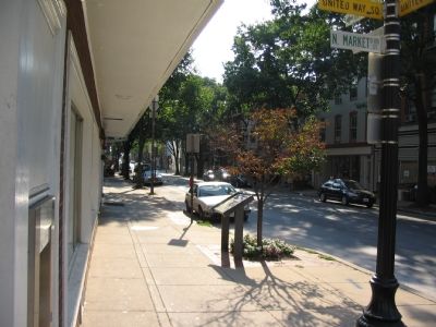
Location. 39° 24.856′ N, 77° 24.637′ W. Marker is in Frederick, Maryland, in Frederick County. Marker is at the intersection of East Patrick Street (State Highway 144) and South Market Street, on the right when traveling west on East Patrick Street. Touch for map. Marker is in this post office area: Frederick MD 21701, United States of America. Touch for directions.
Other nearby markers. At least 8 other markers are within walking distance of this marker. A Crossroads of American History (within shouting distance of this marker); Arts & Entertainment (within shouting distance of this marker); The News (about 300 feet away, measured in a direct line); The Weinberg Center (about 300 feet away); Capital For A Summer (about 400 feet away); Kemp Hall (about 400 feet away); 1862 Antietam Campaign (about 400 feet away); Hospitals in Frederick (about 400 feet away). Touch for a list and map of all markers in Frederick.
More about this marker. The marker displays portraits of Generals Meade and Lee in addition to one of Jacob Englebrecht.
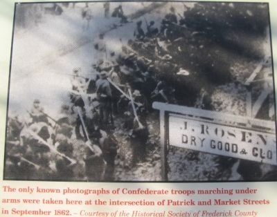
In the upper center is a photograph captioned, "The only known photographs of Confederate troops
marching under arms were taken here at the intersection of Patrick and Market Streets in September 1862."
On the upper right is a "Harpers Weekly sketch of Frederick while occupied by troops."
Also see . . . On this spot: Two history buffs debunk the story of a famous Civil War photo. 2018 article by John Kelly in the Washington Post. ‘Reproduced in countless books, it shows nearly 100 men, most with rifles resting on their right shoulders, a few looking toward the camera, their faces inscrutable. And to think it was taken on that very street in 1862! Except, it wasn’t. ’ (Submitted on June 7, 2018.)
Credits. This page was last revised on June 7, 2018. It was originally submitted on October 6, 2007, by Craig Swain of Leesburg, Virginia. This page has been viewed 2,223 times since then and 41 times this year. Photos: 1, 2, 3. submitted on October 6, 2007, by Craig Swain of Leesburg, Virginia.


