Buckhead in Atlanta in Fulton County, Georgia — The American South (South Atlantic)
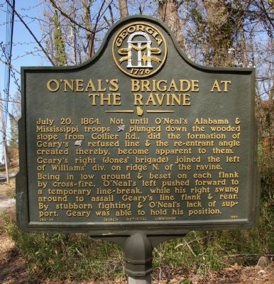
OíNealís Brigade at the Ravine
Gearyís right (Jonesí brigade) joined the left of Williamsí div. on ridge N. of the ravine.
Being in low ground & beset on each flank by cross-fire, OíNealís left pushed forward to a temporary line-break, while his right swung around to assail Gearyís line flank & rear. By stubborn fighting & OíNealís lack of support, Geary was able to hold his position.
Erected 1955 by Georgia Historical Commission. (Marker Number 060-45.)
Topics and series. This historical marker is listed in this topic list: War, US Civil. In addition, it is included in the Georgia Historical Society series list. A significant historical date for this entry is July 20, 1907.
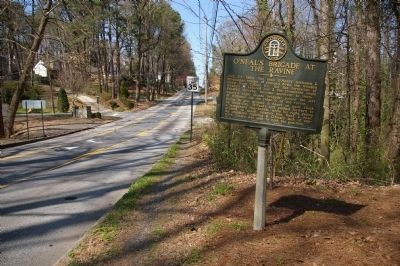
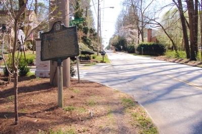
Location. 33° 48.748′ N, 84° 24.464′ W. Marker is in Atlanta, Georgia, in Fulton County. It is in Buckhead. Marker is at the intersection of Northside Drive (U.S. 41) and Overbrook Drive, on the right when traveling north on Northside Drive. Touch for map. Marker is in this post office area: Atlanta GA 30318, United States of America. Touch for directions.
Other nearby markers. At least 8 other markers are within walking distance of this marker. Williams' Div. Deployed (about 400 feet away, measured in a direct line); Gearyís Refused Line (approx. 0.2 miles away); OíNealís Brigade (approx. 0.2 miles away); Gearyís Division (approx. ľ mile away); On Geary's Front (approx. ľ mile away); Reynoldsí Brigade at the Ravine (approx. 0.3 miles away); The Battle of Peachtree Creek (approx. 0.3 miles away); The Federal Forces Engaged/The Confederate Forces Engaged (approx. 0.3 miles away). Touch for a list and map of all markers in Atlanta.
Regarding OíNealís Brigade at the Ravine. These skirmishes were part of the Battle of Peachtree Creek.
Credits. This page was last revised on February 8, 2023. It was originally submitted on April 2, 2010, by David Seibert of Sandy Springs, Georgia. This page has been viewed 972 times since then and 19 times this year. Photos: 1, 2, 3, 4. submitted on April 2, 2010, by David Seibert of Sandy Springs, Georgia. • Craig Swain was the editor who published this page.


