Buffalo Junction in Mecklenburg County, Virginia — The American South (Mid-Atlantic)
Buffalo Springs
Interpretive Trail
— John H. Kerr Dam & Reservoir —
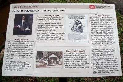
In 1728, a survey party led by William Byrd II visited these springs. In his diary he wrote that the spring water was: “…what Adam drank in Paradise … by the help of which we perceived our appetites to mend, our slumber to sweeten, the stream of life to run cool and peaceably in veins, and if ever we dreamt of women, they were kind.”
Byrd sighted a buffalo near the springs, hence the name Buffalo Springs. Beginning in 1817 a tavern and, later, a small resort were operating at the springs.
Healing Waters
When Thomas F. Goode acquired the property in 1874, Buffalo Springs gained national prominence.
It was the water that made Buffalo Springs famous. It was believed that lithia found in the spring water was effective in treating gout, rheumatism and several other ailments.
The curative attributes of “Buffalo Lithia Water” were widely touted, and there were nearly 20,000 outlets selling half-gallon jars of the water worldwide.
The Golden Years
The fame of the spring water spurred expansion of the resort. There were hotels, cabins, a tennis court, bowling alley and golf course at Buffalo Springs. Visitors enjoyed horseback riding, nature walks, dancing to live music, and boat rides on a pond.
Times Change
In the early 20th century medical knowledge and treatment improved dramatically. The amount of Lithia in spring water was no longer considered to be medically effective.
However, “Buffalo Lithia Water” continued to be marketed until a 1914 court ruling disallowed the use of the word “lithia” to sell the water of Buffalo Springs. Worse yet, the court ruling stated that, “… for a person to obtain any therapeutic dose of lithium by drinking Buffalo Lithia Spring Water he would have to drink from 150,000 to 225,000 gallons per day.”
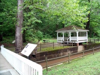
Even after “Buffalo Lithia Water” fell out of favor, the resort continued to be popular with locals. In 1949, the U.S. Army Corps of Engineers purchased the land around Buffalo Springs for the John H. Kerr Reservoir. The buildings and their contents were auctioned and hauled off. About all that is left of the resort is a gazebo and a tap from which locals still come to fill their bottles and jugs with the water that “Adam drank in Paradise.”
Erected by US Army Corps of Engineers, Wilmington District.
Topics. This historical marker is listed in these topic lists: Man-Made Features • Natural Features • Natural Resources • Notable Places. A significant historical year for this entry is 1728.
Location. 36° 38.907′ N, 78° 39.728′ W. Marker is in Buffalo Junction, Virginia, in Mecklenburg County. Marker can be reached from Buffalo Springs Road (Virginia Route 767) 0.2 miles north of Highway Fifty Eight (U.S. 58). This marker is located at the Buffalo Springs Historic Site. Touch for map. Marker is in this post office area: Buffalo Junction VA 24529, United States of America. Touch for directions.
Other nearby markers. At least 8 other markers are within 6 miles of this marker, measured as the crow flies. A different marker also named Buffalo Springs (a few steps from this marker); a different marker also named Buffalo Springs (a few steps from this marker); a different marker also named Buffalo Springs (approx. 0.2 miles away); Mecklenburg County / Halifax County (approx. 2.2 miles away); Charlotte County / Mecklenburg County (approx. 5.4 miles away); Prestwould Plantation (approx. 5.7 miles away); Mecklenburg County Veterans Memorial (approx. 5.7 miles away); Patrick Robert “Parker” Sydnor (approx. 6 miles away). Touch for a list and map of all markers in Buffalo Junction.
More about this marker. On the upper left is a painting of “William Byrd II”.
On the upper center is a Buffalo Lithia Spring advertisement and on the lower center is a photo of the “Bowling Alley, Lithia Springs, Va.”
Also see . . . Buffalo Springs Archaeological District . National Register of Historic Places (Submitted on November 10, 2021.)
Credits. This page was last revised on November 10, 2021. It was originally submitted on May 20, 2010, by Bernard Fisher of Richmond, Virginia. This page has been viewed 1,396 times since then and 76 times this year. Photos: 1, 2. submitted on May 20, 2010, by Bernard Fisher of Richmond, Virginia.

