Buffalo Junction in Mecklenburg County, Virginia — The American South (Mid-Atlantic)
Buffalo Springs
Interpretive Trail
— John H. Kerr Dam & Reservoir —
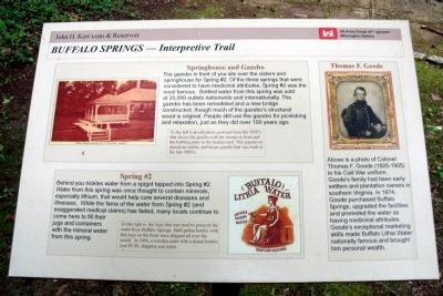
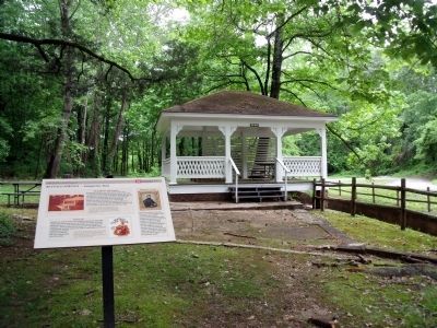
The gazebo in front of you sits over the cistern and springhouse for Spring #2. Of the three springs that were considered to have medicinal attributes, Spring #2 was the most famous. Bottled water from this spring was sold at 20,000 outlets nationwide and internationally. The gazebo has been remodeled and a new bridge constructed, though much of the gazebo’s structural wood is original. People still use the gazebo for picnicking and relaxation, just as they did over 100 years ago.
To the left is an old photo postcard from the 1930’s that shows the gazebo with the stream in front and the bottling plant in the background. This gazebo replaced an earlier, and larger gazebo that was built in the late 1800’s.
Spring #2
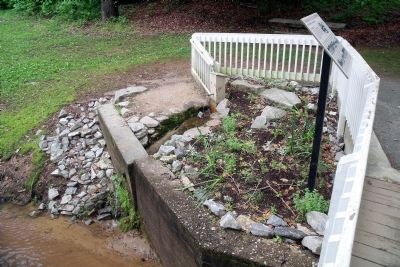
Behind you trickles water from a spigot tapped into Spring #2. Water from this spring was once thought to contain minerals, especially lithium, that would help cure several diseases and illnesses. While the fame of the water from Spring #2 (and exaggerated medical claims) has faded, many locals continue to come here to fill their jugs and containers with the mineral water from this spring.
To the right is the logo that was used to promote the water from Buffalo Springs. Half-gallon bottles with the logo on the front were shipped all over the world. In 1900, a wooden crate with a dozen bottles cost $5.00, shipping was extra.
Thomas F. Goode
Above is a photo of Colonel Thomas F. Goode (1825-1905) in his Civil War uniform. Goode’s family had been early settlers and plantation owners in southern Virginia. In 1874, Goode purchased Buffalo Springs, upgraded the facilities and promoted the water as having medicinal attributes. Goode’s exceptional marketing skills made Buffalo Lithia Water nationally famous and brought him personal wealth.
Erected by US Army Corps of Engineers, Wilmington District.
Topics. This historical marker is listed in these topic lists: Man-Made Features • Natural Features • Natural Resources • Notable Places. A significant historical year for this entry is 1900.
Location. 36° 38.899′ N, 78° 39.734′ W. Marker is in Buffalo Junction, Virginia, in Mecklenburg County. Marker can be reached from Buffalo Springs Road (Virginia Route 767) 0.2 miles north of Highway Fifty Eight (U.S. 58). This marker is located at the Buffalo Springs Historic Site. Touch for map. Marker is in this post office area: Buffalo Junction VA 24529, United States of America. Touch for directions.
Other nearby markers. At least 8 other markers are within 6 miles of this marker, measured as the crow flies. A different marker also named Buffalo Springs (a few steps from this marker); a different marker also named Buffalo Springs (a few steps from this marker); a different marker also named Buffalo Springs (approx. 0.2 miles away); Mecklenburg County / Halifax County (approx. 2.2 miles away); Charlotte County / Mecklenburg County (approx. 5˝ miles away); Prestwould Plantation (approx. 5.7 miles away); Mecklenburg County Veterans Memorial (approx. 5.7 miles away); Sunnyside School ca. 1870-1908 (approx. 5.8 miles away). Touch for a list and map of all markers in Buffalo Junction.
Regarding Buffalo Springs. On the upper left is a photo of “Buffalo Mineral Springs No. 2, Clarksville, Virginia”
On the lower center is the logo of Buffalo Lithia Water.
On the upper right is a photo of “Thomas F. Goode”
Credits. This page was last revised on June 16, 2016. It was originally submitted on May 20, 2010, by Bernard Fisher of Richmond, Virginia. This page has been viewed 1,065 times since then and 19 times this year. Photos: 1, 2, 3. submitted on May 20, 2010, by Bernard Fisher of Richmond, Virginia.


