Near Frederick in Frederick County, Maryland — The American Northeast (Mid-Atlantic)
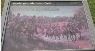
Worthington-McKinney Ford
11:00 a.m.-3:00 p.m. July 9, 1864
— Monocacy National Battlefield, National Park Service, U.S. Department of the Interior —
Erected by National Park Service, U.S. Department of the Interior.
Topics. This historical marker is listed in this topic list: War, US Civil. A significant historical month for this entry is July 1846.
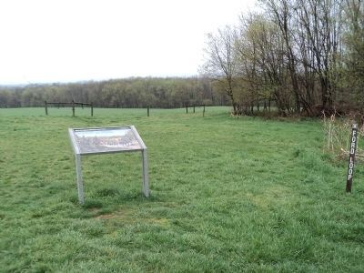
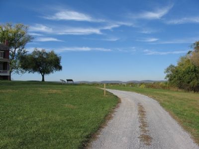
Location. Marker has been reported permanently removed. It was located near 39° 21.702′ N, 77° 24.131′ W. Marker was near Frederick, Maryland, in Frederick County. Marker could be reached from Baker Valley Road when traveling south. Located at stop three of the auto-tour of Monocacy Battlefield. This marker set is at the trail head for the Worthington Farm walking tour. To reach the stop, from Baker Valley Road, turn northwest onto the park service road (running parallel to Interstate 270, from which there is no direct access). Follow the service road to the parking lot near the Worthington House. Touch for map. Marker was in this post office area: Frederick MD 21704, United States of America.
We have been informed that this sign or monument is no longer there and will not be replaced. This page is an archival view of what was.
Other nearby markers. At least 8 other markers are within walking distance of this location. Through a Child's Eyes (within shouting distance of this marker); Ambush (within shouting distance of this marker); Caught in the Crossfire (approx. 0.6 miles away); L'Hermitage (approx. 0.6 miles away); 1862 Antietam Campaign (approx. 0.6 miles away); The Lost Order (approx. 0.6 miles away); Final Attack (approx. 0.7 miles away); Civilians Under Siege (approx. 0.7 miles away). Touch for a list and map of all markers in Frederick.
More about this marker. The background image on the marker shows Confederate cavalry crossing at the ford.
Also see . . . Battle of Monocacy. National Park Service site. (Submitted on November 4, 2007, by Craig Swain of Leesburg, Virginia.)
Photographed By Craig Swain, November 3, 2007
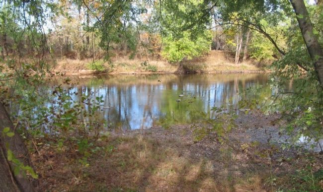
4. Worthington-McKinney Ford
The exact location of the ford cannot be plotted accurately as the river course has changed somewhat since the battle. Primary sources locate it near the mouth of Ballenger Creek, which has been diverted somewhat due to development on the west bank.
While the Monocacy is not a terribly deep course, nor very wide, from a military perspective just simply being able to cross a river is not enough. Military units require ground to stage prior to crossing, a wide enough trace to afford multi-file or two way traffic, and finally ground to reassemble the unit on the far side. Additionally, the crossing point should have some nearby terrain feature, such as a ridge or hill, to place artillery in order to suppress the enemy resistance to the crossing. Lastly, if possible, the crossing site should allow some degree of concealment from the enemy, lest the unit be attacked in mid-crossing. The commander's reports of the Monocacy Battle underscores these requirements as leaders struggled to locate proper military fords to bring their units into action.
While the Monocacy is not a terribly deep course, nor very wide, from a military perspective just simply being able to cross a river is not enough. Military units require ground to stage prior to crossing, a wide enough trace to afford multi-file or two way traffic, and finally ground to reassemble the unit on the far side. Additionally, the crossing point should have some nearby terrain feature, such as a ridge or hill, to place artillery in order to suppress the enemy resistance to the crossing. Lastly, if possible, the crossing site should allow some degree of concealment from the enemy, lest the unit be attacked in mid-crossing. The commander's reports of the Monocacy Battle underscores these requirements as leaders struggled to locate proper military fords to bring their units into action.
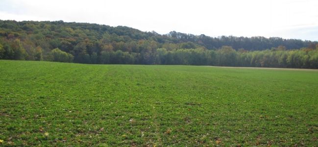
Photographed By Craig Swain, November 3, 2007
5. Confederate Staging Area
Around this field, and several others on the banks of the Monocacy to the southwest of Worthington House, Confederates under Gen. John B. Gordon re-assembled after crossing the ford. In the background looms Brooks Hill, which concealed them from Federal artillery and observers.
Credits. This page was last revised on April 17, 2022. It was originally submitted on November 4, 2007, by Craig Swain of Leesburg, Virginia. This page has been viewed 1,905 times since then and 25 times this year. Last updated on March 23, 2022, by Connor Olson of Kewaskum, Wisconsin. Photos: 1. submitted on November 4, 2007, by Craig Swain of Leesburg, Virginia. 2. submitted on April 23, 2011, by Bill Coughlin of Woodland Park, New Jersey. 3, 4, 5. submitted on November 4, 2007, by Craig Swain of Leesburg, Virginia. • J. Makali Bruton was the editor who published this page.
