Marker Logo HMdb.org THE HISTORICAL
MARKER DATABASE
“Bite-Size Bits of Local, National, and Global History”
Near Wellsburg in Brooke County, West Virginia — The American South (Appalachia)
 

George Washington Crossing, 1770


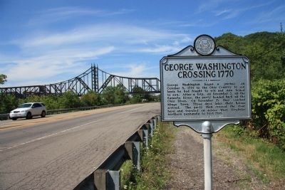
George Washington Crossing, 1770 Marker image. Click for full size.
Photographed By Dale K. Benington, July 26, 2010
1. George Washington Crossing, 1770 Marker
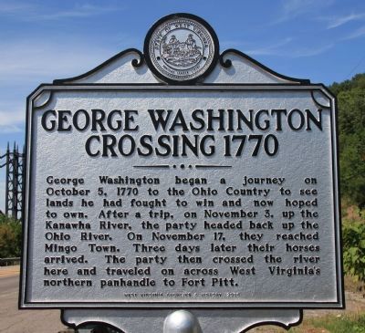
Inscription. George Washington began a journey on October 5, 1770 to the Ohio Country to see lands he had fought to win and now hoped to own. After a trip, on November 3, up the Kanawha River, the party headed back up the Ohio River. On November 17, they reached Mingo Town. Three days later their horses arrived. The party then crossed the river here and traveled on across West Virginia's northern panhandle to Fort Pitt.
 
Erected 2008 by West Virginia Archives & History.
 
Topics and series. This historical marker is listed in these topic lists: Colonial EraExplorationForts and CastlesWaterways & Vessels. In addition, it is included in the Former U.S. Presidents: #01 George Washington, and the West Virginia Archives and History series lists. A significant historical month for this entry is October 1854.
 
Location. 40° 18.473′ N, 80° 35.986′ W. Marker is near Wellsburg, West Virginia, in Brooke County. Marker is on West Virginia Route 2, 0.1 miles north of Cross Creek Road, on the right when traveling north. This historic marker is located on the east side of State Route 2 (opposite the Ohio River), just north of the Cross Creek Bridge. Touch for map. Marker is in this post office area: Wellsburg WV 26070, United States of America. Touch for directions.
 
Other nearby markers. At least 8 other markers are within 2 miles of this marker, measured as the
Paid Advertisement
Click on the ad for more information.
Please report objectionable advertising to the Editor.
Click or scan to see
this page online
crow flies. Fort Decker (approx. 1.1 miles away); Women Of All Wars (approx. 1˝ miles away); Joseph "Joey" Perito (approx. 1˝ miles away); Veterans Memorial (approx. 1˝ miles away); All Gave Some · Some Gave All (approx. 1˝ miles away); Patrick M. Gass (approx. 1.6 miles away); Patrick Gass (approx. 1.7 miles away); Brooke County Veterans Memorial (approx. 2 miles away). Touch for a list and map of all markers in Wellsburg.
 
George Washington Crossing, 1770 Marker image. Click for full size.
Photographed By Dale K. Benington, July 26, 2010
2. George Washington Crossing, 1770 Marker
View looking north up State Route 2, with a view of the railroad bridge across the Ohio River in the background.
George Washington Crossing, 1770 Marker image. Click for full size.
Photographed By Dale K. Benington, July 26, 2010
3. George Washington Crossing, 1770 Marker
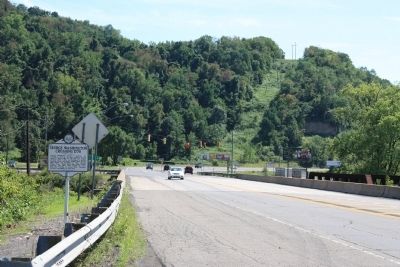
View looking south down State Route 2, with a view of the Ohio River on the right side of the picture.
George Washington Crossing, 1770 Marker image. Click for full size.
Photographed By Dale K. Benington, July 26, 2010
4. George Washington Crossing, 1770 Marker
Another view looking south down State Route 2, with a view of the intersection with Cross Creek Road in the background.
 
 
Credits. This page was last revised on December 28, 2019. It was originally submitted on August 2, 2010, by Dale K. Benington of Toledo, Ohio. This page has been viewed 2,869 times since then and 93 times this year. Photos:   1, 2, 3, 4. submitted on August 2, 2010, by Dale K. Benington of Toledo, Ohio.
Share this page.  
Share on Tumblr
m=33913

CeraNet Cloud Computing sponsors the Historical Marker Database.
This website earns income from purchases you make after using our links to Amazon.com. We appreciate your support.
Paid Advertisement
Apr. 26, 2024