Nelson in Newport News, Virginia — The American South (Mid-Atlantic)
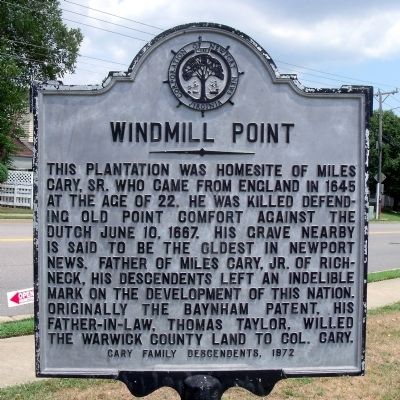
Windmill Point
Erected 1972 by Cary Family Descendents.
Topics and series. This historical marker is listed in these topic lists: Cemeteries & Burial Sites • Colonial Era. In addition, it is included in the Virginia, Corporation of Newport News series list. A significant historical date for this entry is June 10, 1897.
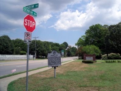
Location. 37° 7.467′ N, 76° 33.435′ W. Marker is in Newport News, Virginia. It is in Nelson. Marker is at the intersection of Denbigh Boulevard (Virginia Route 173) and Garrow Road, on the left when traveling south on Denbigh Boulevard. Touch for map. Marker is in this post office area: Newport News VA 23608, United States of America. Touch for directions.
Other nearby markers. At least 8 other markers are within 2 miles of this marker, measured as the crow flies. Olivet Christian Church (approx. 0.9 miles away); The Courthouse Square (approx. 0.9 miles away); The Free State of Warwick (approx. 0.9 miles away); Warwick Court House (approx. 0.9 miles away); Reflecting a Changing Society (approx. 0.9 miles away); Warwick Courthouse (approx. 0.9 miles away); a different marker also named Warwick Courthouse (approx. 0.9 miles away); Two USCT Heroes (approx. 1.9 miles away). Touch for a list and map of all markers in Newport News.
Credits. This page was last revised on February 1, 2023. It was originally submitted on August 3, 2010, by Bernard Fisher of Richmond, Virginia. This page has been viewed 1,951 times since then and 147 times this year. Photos: 1, 2. submitted on August 3, 2010, by Bernard Fisher of Richmond, Virginia.

