Bethesda in Montgomery County, Maryland — The American Northeast (Mid-Atlantic)
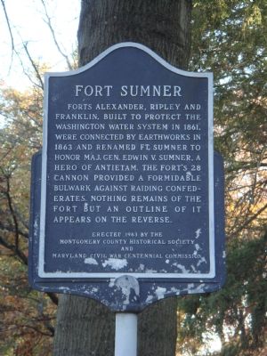
Fort Sumner
Erected 1963 by the Montgomery County Historical Society and Maryland Civil War Centennial Commission.
Topics and series. This historical marker is listed in these topic lists: Forts and Castles • War, US Civil • Waterways & Vessels. In addition, it is included in the Defenses of Washington series list. A significant historical year for this entry is 1861.
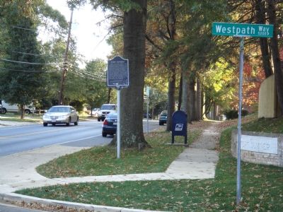
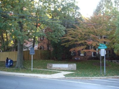
Location. 38° 57.379′ N, 77° 7.32′ W. Marker is in Bethesda, Maryland, in Montgomery County. Marker is at the intersection of Sangamore Road and Westpath Way, on the left when traveling north on Sangamore Road. Touch for map. Marker is at or near this postal address: 5200 Westpath Way, Bethesda MD 20816, United States of America. Touch for directions.
Other nearby markers. At least 8 other markers are within walking distance of this marker. A Way for Fish (approx. 0.6 miles away); Defending the City of Washington (approx. 0.7 miles away); Artist's Conception of Battery Bailey, Circa 1862 (approx. 0.7 miles away); What is a Battery? (approx. 0.7 miles away); Col. Guilford Dudley Bailey (approx. 0.7 miles away); Battery Bailey (approx. ¾ mile away); Lockhouse 6 (approx. 0.8 miles away); Loughborough Mill (approx. 0.8 miles away). Touch for a list and map of all markers in Bethesda.
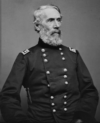
Also see . . . Wikipedia entry for Edwin Vose Sumner, U.S. Army. (Submitted on March 27, 2011, by Richard E. Miller of Oxon Hill, Maryland.)
Additional commentary.
1. "The Fort"
When I was a boy my friends and I played on the vine-covered sides and gun emplacements of Ft. Sumner. It was known to all as, simply, "The Fort". I lived barely 100 yards from it on Wehawken Road. Sangamore Road was then a country lane and Westpath Way didn't exist. My sister, who now lives in Montgomery Hills, found a cannonbal on "The Fort". It was hollow and had holes opposite each other so my father put a rope through it, used it for an anchor, and lost it in the Potomac. I have four foot section of roughsawn floor joist from one of the barracks in my garage here in Oregon. Yes, I graduated from
"BCC High School" in 1955 and turned 72 last December. There was a little "island of diversity" hard upon the sides of that fort in the '40s and '50s. Descendants of freed slaves who had moved into the fort after the Civil War still lived there, across the street from wartime government workers from all over the US. It was a colorful, wonderful, time to grow up.
— Submitted May 14, 2010, by Joseph F. Ward of Shady Cove, Oregon.
Credits. This page was last revised on November 22, 2019. It was originally submitted on November 11, 2007, by J. J. Prats of Powell, Ohio. This page has been viewed 4,348 times since then and 67 times this year. Photos: 1, 2, 3, 4. submitted on November 11, 2007, by J. J. Prats of Powell, Ohio. 5. submitted on December 22, 2012, by Richard E. Miller of Oxon Hill, Maryland.


