Tompkins Cove in Rockland County, New York — The American Northeast (Mid-Atlantic)
Hudson River Reserve Fleet
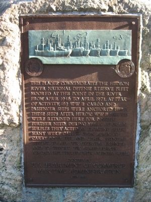
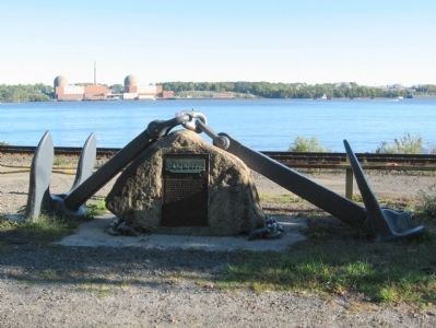
This plaque commemorates the hudson river national defense reserve fleet moored at this point in the river from April 1946 to April 1971. At peak of activity, 189 WW II cargo and passenger ships were anchored here. These ships after heroic WW II service were retained here for possible further need. During years of grain surplus they acted as floating silos. Many were called upon again to carry food, fuel and other essential supplies to aid our overseas friends and to support our armed forces abroad. They served their country well.
U.S. Department of Commerce
Maritime Administration
July 1971
Erected 1971 by U.S. Department of Commerce Maritime Administration.
Topics. This historical marker is listed in this topic list: Waterways & Vessels. A significant historical month for this entry is April 1946.
Location. 41° 16.756′ N, 73° 58.044′ W. Marker is in Tompkins Cove, New York, in Rockland County. Marker is on U.S. 9W, 0.1 miles north of Thunder Mountain Road, on the right when traveling north. Touch for map. Marker is in this post office area: Tomkins Cove NY 10986, United States of America. Touch for directions.
Other nearby markers. At least 8 other markers are within 2 miles of this marker, measured as the crow flies. Travis Cove Overlook (approx. 1˝ miles away); Bear Mountain Bridge Toll House (approx. 1.7 miles away); Gray’s Hill (approx. 1.8 miles away); Doodletown (approx. 1.8 miles away); Buckberg Mountain (approx. 1.8 miles away); Camp Smith (approx. 1.9 miles away); Countess Lucille VI (approx. 1.9 miles away); Peekskill F.D.N.Y. Memorial (approx. 1.9 miles away).
Regarding Hudson River Reserve Fleet.
In 1946, an act of Congress created the National Defense Reserve Fleet, a flotilla of commercial ships that stood in reserve, ready to be reactivated in times of war or national emergency. The "Mothball Fleet" was docked at eight locations around the country, including at this spot on the Hudson River. In 1965, 189 ships were anchored here, lined up in 10 rows which extended several miles to the north. Viewing areas were set up along the roadside to accommodate the scores of motorists who stopped daily to view the ships.
Vessels from the Hudson River group saw action in the Korean and Vietnam wars, and helped ferry goods during the 1956 Suez Canal crisis. But perhaps the fleet’s biggest contribution to history was its use as a floating silo. Between 1955 and 1964, more that 53 million bushels of wheat were stored on the ships, each
of which was outfitted with a special ventilation system that kept the grain from spoiling.
While laid up in the river, the fleet was maintained by a crew of 86 workers. Using a method called cathodic protection, they passed electric current through the underwater portion of the hull to prevent corrosion. Loose scales and rust were water-blasted from the decks and hulls, and the whole exterior of each ship was covered with a gray colored preservative oil. By the mid-’60s, the cost of keeping the Hudson fleet seaworthy had risen to nearly $800,000 a year. The last two ships in the Hudson River Reserve Fleet sailed for Spain in July 1971, to be scrapped.
Reserve fleets are still maintained at James River, Virginia; Suisun Bay, California; and Beaumont, Texas.
Credits. This page was last revised on June 16, 2016. It was originally submitted on October 11, 2010, by Michael Herrick of Southbury, Connecticut. This page has been viewed 4,469 times since then and 72 times this year. Photos: 1, 2. submitted on October 11, 2010, by Michael Herrick of Southbury, Connecticut.

