Chelsea in Shelby County, Alabama — The American South (East South Central)
City Of Chelsea
Incorporated March 1, 1996
— Mayor S. Earl Niven —
Side A
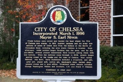
Creek Indians once owned and hunted the land where the City of Chelsea now stands. In 1813, Andrew Jackson and his army won millions of acres of Creek land from the Indians at the Battle of Horseshoe Bend, including the area where Chelsea is located. Soon afterward, white settlers began flocking into the area, and by the mid-1800s, several pioneer homesteads were located among these hills and hollows. When the railroad came through in 1908, people began moving closer to the tracks and the town of Chelsea, first called Melrose, was born. Early businesses included a drugstore, saw mill, grist mill, planer mill, cotton gin, blacksmith shop, barber shop, general stores and a post office. Prominent store owners included George Washington Weldon and brothers, C.W. and Frank P. Chesser.
Side B
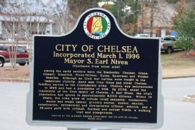
Among the early settlers were the Blackerby, Chesser, Crane, Gilbert, Kendrick, Niven/Nivens, Quinn, Spearman and Weldon families. Although no Civil War Battles were fought in the immediate vicinity, many men from these and other Chelsea families served in the Confederate Army. Chelsea was incorporated in 1996 and had a population of 906. By 2008, under the leadership of the first mayor of Chelsea, S. Earl Niven, the city’s population had grown to approximately 9,000 citizens. Within 10 years, the town grew to include retail shopping; restaurants; banks and credit unions; grocery stores; doctor, dentist, veterinarian, optometrist and chiropractor offices; schools, and a 29-acre park with softball, football and soccer fields, a walking trail and playgrounds.
Erected 2010 by Alabama Tourism Department and The City of Chelsea.
Topics and series. This historical marker is listed in these topic lists: Native Americans • Settlements & Settlers • Wars, US Indian. In addition, it is included in the Former U.S. Presidents: #07 Andrew Jackson series list. A significant historical year for this entry is 1813.
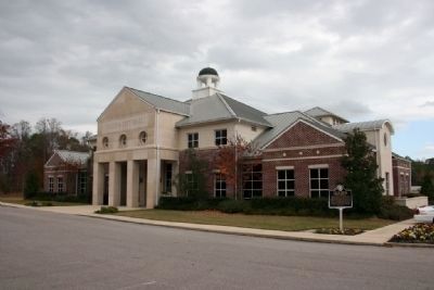
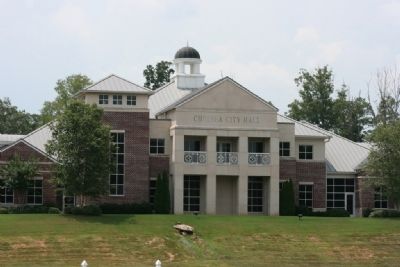
Location. 33° 20.432′ N, 86° 37.914′ W. Marker is in Chelsea, Alabama, in Shelby County. Marker can be reached from Chelsea Road (County Road 47) near County Road 39. Marker located on the west side of the Chelsea City Hall. Touch for map. Marker is at or near this postal address: 11611 Chelsea Road, Chelsea AL 35043, United States of America. Touch for directions.
Other nearby markers. At least 8 other markers are within 11 miles of this marker, measured as the crow flies. Old Quinn Burying Ground (approx. one mile away); Mount Tabor United Methodist Church Cemetery (approx. 5.6 miles away); Town of Westover (approx. 6.6 miles away); Pelham, Alabama / Ballantrae Golf Course (approx. 9.1 miles away); Rocky Ridge Elementary School (approx. 9.1 miles away); Briarwood Presbyterian Church PCA (approx. 9.1 miles away); Birmingham Water Works Company (1887) / Cahaba Pumping Station (1890) (approx. 9.1 miles away); Hoover (approx. 10.6 miles away).
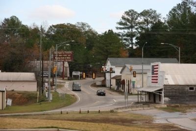
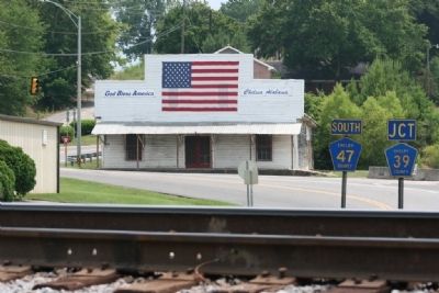
More about this marker. Chelsea City Hall is located about 1/2 mile off U.S. Highway 280. From U.S. Highway 280, turn at Chelsea Road (County Road 47) the road crosses the railroad tracks, city hall stands on a hill on the right after crossing the tracks. Turn right onto County Road 39 at the traffic light and proceed to Twin Oaks Circle, turn right onto Twin Oaks Circle, then take another right to the city hall parking area.
Also see . . .
1. City Of Chelsea, Alabama Website. (Submitted on November 28, 2010, by Timothy Carr of Birmingham, Alabama.)
2. Chelsea. "Encyclopedia of Alabama" entry. (Submitted on September 1, 2020, by Larry Gertner of New York, New York.)
Credits. This page was last revised on March 24, 2023. It was originally submitted on November 28, 2010, by Timothy Carr of Birmingham, Alabama. This page has been viewed 2,047 times since then and 109 times this year. Photos: 1, 2, 3, 4, 5, 6, 7. submitted on November 28, 2010, by Timothy Carr of Birmingham, Alabama. • Bill Pfingsten was the editor who published this page.
