Montezuma Castle National Monument in Yavapai County, Arizona — The American Mountains (Southwest)
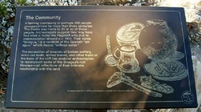
The Community
A farming community of perhaps 200 people prospered here for more than three centuries. The Castle was home to 35 or so of these people. Archeologists suggest they may have fled what is today the Flagstaff area due to overpopulation around A.D. 1100. Their name, “Sinagua,” is a variation of the Spanish “sin agua,” which means “without water.”
The excavation of mounds of broken pottery, worn-out tools, animal bones, and other trash at the base of the cliff has enabled archeologists to reconstruct some of the Sinagua’s rich lifeways – all reflections of their intimate relationship with the land.
Erected by National Park Service.
Topics. This historical marker is listed in these topic lists: Anthropology & Archaeology • Forts and Castles • Native Americans • Settlements & Settlers.
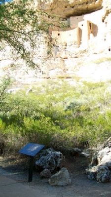
Location. 34° 36.713′ N, 111° 50.485′ W. Marker is in Montezuma Castle National Monument, Arizona, in Yavapai County. Marker is along the walking trail leading from the visitor center. Touch for map. Marker is at or near this postal address: Montezuma Castle Road, Camp Verde AZ 86322, United States of America. Touch for directions.
Other nearby markers. At least 8 other markers are within 3 miles of this marker, measured as the crow flies. Welcome to The Castle (within shouting distance of this marker); The Way Up / Construction Sequence (within shouting distance of this marker); The Neighborhood / Mysterious Departures (about 300 feet away, measured in a direct line); The People Next Door (about 400 feet away); Lifeline / Prehistoric Produce (about 400 feet away); Macaw Pen Stone? (about 400 feet away); Pecan Lane Rural Historic Landscape (approx. 2.7 miles away); Chaves Historic Trail (approx. 2.9 miles away). Touch for a list and map of all markers in Montezuma Castle National Monument.
Also see . . . Montezuma Castle National Monument. (Submitted on March 13, 2011, by William Fischer, Jr. of Scranton, Pennsylvania.)
Credits. This page was last revised on June 16, 2016. It was originally submitted on March 13, 2011, by William Fischer, Jr. of Scranton, Pennsylvania. This page has been viewed 718 times since then and 8 times this year. Photos: 1, 2. submitted on March 13, 2011, by William Fischer, Jr. of Scranton, Pennsylvania.

