McKees Rocks Bottoms in Allegheny County, Pennsylvania — The American Northeast (Mid-Atlantic)
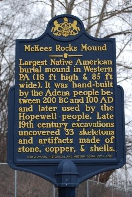
McKees Rocks Mound
Erected 2002 by Pennsylvania Historical and Museum Commission.
Topics and series. This historical marker is listed in these topic lists: Anthropology & Archaeology • Native Americans. In addition, it is included in the Pennsylvania Historical and Museum Commission series list.
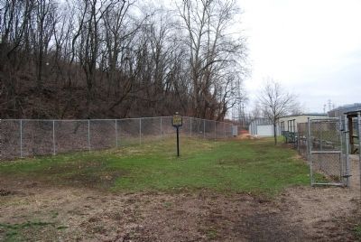
Location. 40° 28.38′ N, 80° 3.095′ W. Marker is in McKees Rocks, Pennsylvania, in Allegheny County. It is in McKees Rocks Bottoms. Marker can be reached from Sproul Street, 0.1 miles east of Shingiss Street. Located behind the Rangers Field ballpark at the end of Sproul Street. Touch for map. Marker is in this post office area: Mc Kees Rocks PA 15136, United States of America. Touch for directions.
Other nearby markers. At least 8 other markers are within one mile of this marker, measured as the crow flies. St. Mary's Ukrainian Orthodox Church (approx. 0.3 miles away); Twenty-Four Residents (approx. 0.4 miles away); 1909 McKee's Rocks Strike (approx. half a mile away); The McKee Mansion (approx. half a mile away); Presston (approx. 0.9 miles away); Saint Mary's World War II Honor Roll (approx. one mile away); Saint Mary's Parish World War II Memorial (approx. one mile away); In Memory of John (Jack) Brennan (approx. one mile away). Touch for a list and map of all markers in McKees Rocks.
Also see . . . McKees Rocks Mound - Behind the Marker. ExplorePAhistory.com (Submitted on March 15, 2011, by Bernard Fisher of Richmond, Virginia.)
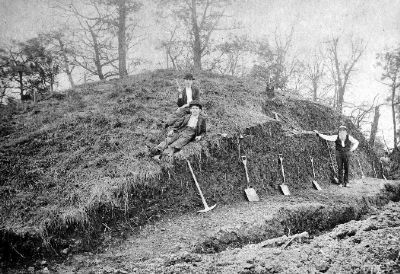
Photographed By Unknown, 1896
4. Initial excavation of McKees Rocks Mound
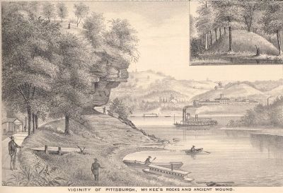
McKees Rocks Mound, the largest mound built in Pennsylvania by Native Americans, was located about four miles south of Pittsburgh, at the confluence of Chartiers Creek and the Ohio River. Before its excavation in 1896 by Frank M. Gerrodette of the Carnegie Museum, the mound was 85 feet in diameter and 16 feet high. Today only a remnant of the original mound survives.
Courtesy of Carnegie Museum of Natural History, Pittsburgh.
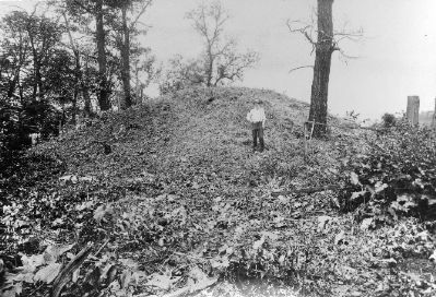
Photographed By Unknown, July 1896
5. McKees Rocks Mound before excavation
In 1896, Frank M. Gerrodette of the Carnegie Museum conducted the first excavation of the McKees Rocks Mound and discovered three construction layers, each of which contained human burials. The lower layers dated to the Early Woodland Adena culture, ca. 1200BC-500BC, and the upper layer to the Middle Woodland Hopewell culture, ca. 500BC-800AD. Today only a remnant of the original mound survives.
Courtesy of Carnegie Museum of Natural History, Pittsburgh
Credits. This page was last revised on February 2, 2023. It was originally submitted on March 14, 2011, by Mike Wintermantel of Pittsburgh, Pennsylvania. This page has been viewed 2,698 times since then and 163 times this year. Photos: 1, 2. submitted on March 14, 2011, by Mike Wintermantel of Pittsburgh, Pennsylvania. 3, 4, 5. submitted on July 26, 2011, by Mike Wintermantel of Pittsburgh, Pennsylvania. • Bernard Fisher was the editor who published this page.
