McDowell in Highland County, Virginia — The American South (Mid-Atlantic)
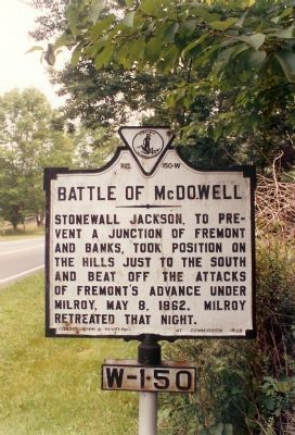
Battle of McDowell
Erected 1928 by Conservation and Development Commission. (Marker Number W-150.)
Topics and series. This historical marker is listed in this topic list: War, US Civil. In addition, it is included in the Virginia Department of Historic Resources (DHR) series list. A significant historical date for this entry is May 8, 1900.
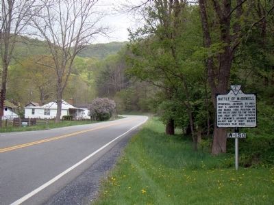
Location. 38° 19.803′ N, 79° 28.451′ W. Marker is in McDowell, Virginia, in Highland County. Marker is on U.S. 250, on the left when traveling west. 1.1 mile East of McDowell. Touch for map. Marker is in this post office area: Mc Dowell VA 24458, United States of America. Touch for directions.
Other nearby markers. At least 8 other markers are within walking distance of this marker. Commemorating The Battle Of McDowell (within shouting distance of this marker); The Ravines (approx. 0.3 miles away); Moving Uphill (approx. 0.4 miles away); The 12th Georgia (approx. 0.4 miles away); Hometown Foes (approx. 0.4 miles away); The Confederate Right (approx. 0.4 miles away); The Battle Rages (approx. half a mile away); Two Plans Of Attack (approx. half a mile away). Touch for a list and map of all markers in McDowell.
Also see . . . Battle of McDowell. National Park Service summary of the battle. (Submitted on December 17, 2007, by Craig Swain of Leesburg, Virginia.)
Credits. This page was last revised on February 1, 2021. It was originally submitted on December 16, 2007, by Mike Stroud of Bluffton, South Carolina. This page has been viewed 2,104 times since then and 24 times this year. Photos: 1. submitted on December 16, 2007, by Mike Stroud of Bluffton, South Carolina. 2. submitted on May 5, 2010, by J. J. Prats of Powell, Ohio. 3, 4. submitted on January 29, 2021, by Bradley Owen of Morgantown, West Virginia. • Craig Swain was the editor who published this page.


