Near East Liverpool in Columbiana County, Ohio — The American Midwest (Great Lakes)
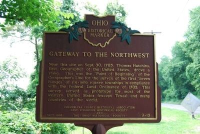
Gateway To The Northwest
Erected 1985 by Columbiana County Historical Association, East Liverpool Historical Society, The Ohio Historical Society. (Marker Number 9-15.)
Topics and series. This historical marker is listed in these topic lists: Colonial Era • Environment. In addition, it is included in the Ohio Historical Society / The Ohio History Connection series list. A significant historical month for this entry is September 1907.
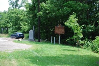
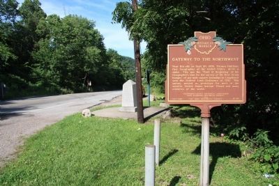
Location. 40° 38.548′ N, 80° 31.142′ W. Marker is near East Liverpool, Ohio, in Columbiana County. Marker is on Harvey Avenue (Ohio Route 39) 0.4 miles east of Bushwick Street, on the right when traveling east. Located at a roadside pull off at the Ohio/Pennsylvania state line. Touch for map. Marker is in this post office area: East Liverpool OH 43920, United States of America. Touch for directions.
Other nearby markers. At least 8 other markers are within one mile of this marker, measured as the crow flies. Land Ordinance of 1785 / The Seven Ranges (here, next to this marker); Down The Ohio (a few steps from this marker in Pennsylvania); The Point of Beginning (a few steps from this marker in Pennsylvania); Beginning Point of the U. S. Public Land Survey (a few steps from this marker); The Sandy and Beaver Canal (approx. 0.4 miles away in Pennsylvania); Smiths Ferry (approx. 0.9 miles away in Pennsylvania); The Penna - Virginia Boundary (approx. 0.9 miles away in Pennsylvania); Georgetown (approx. one mile away in Pennsylvania). Touch for a list and map of all markers in East Liverpool.
Credits. This page was last revised on June 16, 2016. It was originally submitted on July 4, 2011, by Mike Wintermantel of Pittsburgh, Pennsylvania. This page has been viewed 1,079 times since then and 59 times this year. Photos: 1, 2. submitted on July 4, 2011, by Mike Wintermantel of Pittsburgh, Pennsylvania. 3. submitted on September 4, 2011, by Dale K. Benington of Toledo, Ohio.


