St. Augustine in St. Johns County, Florida — The American South (South Atlantic)
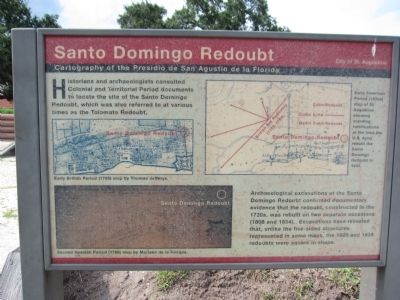
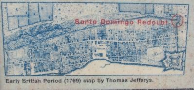
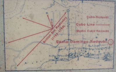
Santo Domingo Redoubt
Cartography of the Presidio de San Agustin de la Florida
Archeological excavations of the Santo Domingo Redoubt confirmed documentary evidence that the redoubt, constructed in the 1730s, was rebuilt on two separate occasions (1808 and 1834). Excavations have revealed that, unlike the five-sided structures represented on some maps, the 1808 and 1834 redoubts were square in shape.
Erected by City of St. Augustine.
Topics. This historical marker is listed in these topic lists: Colonial Era • Forts and Castles. A significant historical year for this entry is 1808.
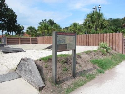
Location. 29° 53.865′ N, 81° 18.898′ W. Marker is in St. Augustine, Florida, in St. Johns County. Marker is at the intersection of Orange Street and Cordova Street, on the right when traveling west on Orange Street. Located beside a earthwork reconstruction of Santo Domingo Redoubt. Touch for map. Marker is in this post office area: Saint Augustine FL 32084, United States of America. Touch for directions.
Other nearby markers. At least 8 other markers are within walking distance of this marker. A different marker also named Santo Domingo Redoubt (a few steps from this marker); The 1886 Old Drugstore (a few steps from this marker); a different marker also named Santo Domingo Redoubt (a few steps from this marker); a different marker also named Santo Domingo Redoubt (a few steps from this marker); The Cubo Line (within shouting distance of this marker); Los Floridanos (within shouting distance of this marker); The Lynching of Isaac Barrett (within shouting distance of this marker); The Lynching of Isaac Barrett / Racial Violence in America (within shouting distance of this marker). Touch for a list and map of all markers in St. Augustine.
Credits. This page was last revised on January 2, 2019. It was originally submitted on August 27, 2011, by Craig Swain of Leesburg, Virginia. This page has been viewed 1,299 times since then and 70 times this year. Photos: 1, 2, 3, 4. submitted on August 27, 2011, by Craig Swain of Leesburg, Virginia.


