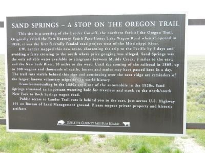
Sand Springs - A Stop on the Oregon Trail
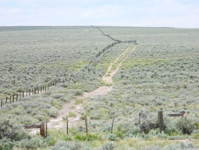
F.W. Lander mapped this new route, shortening the trip to the Pacific by 5 days and avoiding a ferry crossing to the south where price gouging was alleged. Sand Springs was the only reliable water available to emigrants between Muddy Creek, 8 miles to the east, and the New Fork River, 10 miles to the west. Until the coming of the railroad in 1869, up to 300 wagons and thousands of cattle, horses and mules may have passed here in a day. The trail ruts visible behind this sign and continuing over the next ridge are reminders of the largest known voluntary migration in world history.
From homesteading in the 1880s until use of the automobile in the 1920s, Sand Springs remained an important watering hole for travelers and stock on the north/south New Fork to Rock Springs wagon road.
Public access to Lander Trail ruts is behind you to the east, just across U.S. Highway 191 on Bureau of Land Management ground. Please respect private property and historic artifacts.
Erected by Sublette County Museum Board.
Topics. This historical marker is
Location. 42° 37.58′ N, 109° 39.531′ W. Marker is in Boulder, Wyoming, in Sublette County. Marker is on U.S. 191, 1.8 miles west of Wyoming Highway 351, on the right when traveling east. Touch for map. Marker is in this post office area: Boulder WY 82923, United States of America. Touch for directions.
Other nearby markers. At least 8 other markers are within 10 miles of this marker, measured as the crow flies. “The Best Mountain Road in the West” (within shouting distance of this marker); To All Pioneers Who Passed This Way to Win and Hold the West (about 300 feet away, measured in a direct line); Lieutenant J.C. Fremont's Week in Sublette County (approx. 9 miles away); New Fork River Crossing (approx. 9.6 miles away); Rising to the Challenge of the New Fork River (approx. 9.8 miles away); Crossing the New Fork River (approx. 9.8 miles away); "We Busy Ourselves in Various Ways" (approx. 9.8 miles away); The First Engines: Oxen, Mules, and Horses (approx. 9.8 miles away). Touch for a list and map of all markers in Boulder.
Credits. This page was last revised on December 31, 2017. It was originally submitted on September 12, 2011, by Bill Pfingsten of Bel Air, Maryland. This page has been viewed 1,802 times since then and 76 times this year. Photos: 1, 2. submitted on September 12, 2011, by Bill Pfingsten of Bel Air, Maryland.

