Near Burroughs in Chatham County, Georgia — The American South (South Atlantic)
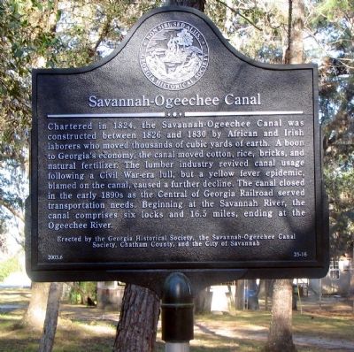
Savannah-Ogeechee Canal
Erected 2003 by Georgia Historical Society, the Savannah-Ogeechee Canal Society, Chatham County, and the City of Savannah. (Marker Number 25-16.)
Topics and series. This historical marker is listed in these topic lists: Agriculture • Industry & Commerce • Waterways & Vessels. In addition, it is included in the Georgia Historical Society series list. A significant historical year for this entry is 1824.
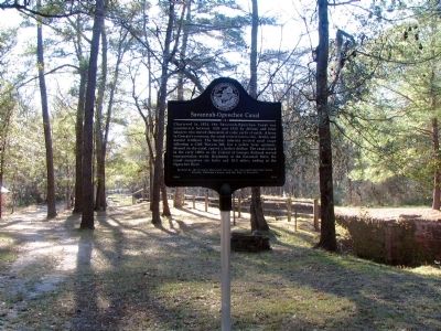
Location. 32° 1.344′ N, 81° 18.94′ W. Marker is near Burroughs, Georgia, in Chatham County. Marker is at the intersection of Fort Argyle Road (Georgia Route 204) and Bush Road, on the left when traveling east on Fort Argyle Road. The marker is off the road, in a small park with a museum and nature center. Touch for map. Marker is at or near this postal address: 681 Fort Argyle Road, Savannah GA 31419, United States of America. Touch for directions.
Other nearby markers. At least 8 other markers are within 6 miles of this marker, measured as the crow flies. The Savannah and Ogeechee Canal (about 600 feet away, measured in a direct line); The 15th Corps at the Savannah and Ogeechee Canal (about 600 feet away); King's Bridge (approx. 3.4 miles away); Fort Argyle (approx. 5 miles away); Hazen's Division at the Canoochee River (approx. 5 miles away); Fort McAllister (approx. 5 miles away); "Dead Town" of Hardwicke (approx. 5 miles away); Courthouse Annex (approx. 5.1 miles away).
Also see . . . Savannah - Ogeechee Canal. (Submitted on October 5, 2008, by David Seibert of Sandy Springs, Georgia.)
Credits. This page was last revised on August 20, 2020. It was originally submitted on October 4, 2008, by David Seibert of Sandy Springs, Georgia. This page has been viewed 2,253 times since then and 28 times this year. Last updated on October 6, 2011, by Edith Greisser of Cross Hill, South Carolina. Photos: 1, 2. submitted on October 4, 2008, by David Seibert of Sandy Springs, Georgia. • Bill Pfingsten was the editor who published this page.

