Blountsville in Blount County, Alabama — The American South (East South Central)
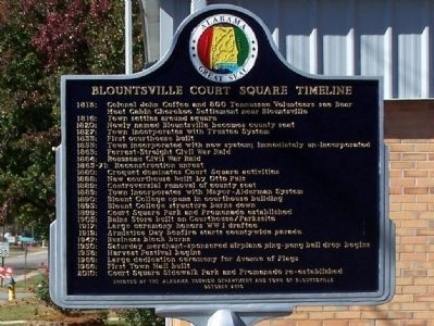
Blountsville Court Square Timeline
1816: Town settles around square
1820: Newly named Blountsville becomes county seat
1827: Town incorporated with Trustee System
1833: First courthouse built
1853: Town incorporated with new system; immediately un-incorporated
1863: Forrest-Streight Civil War Raid
1864: Rousseau Civil War Raid
1865-71: Reconstruction unrest
1880: Croquet dominates Court Square activities
1888: New courthouse built by Otto Puls
1889: Controversial removal of county seat
1889: Town incorporates with Mayor – Alderman System
1890: Blount College opens in courthouse building
1895: Blount College structure burns down
1899: Court Square Park and Promenade established
1905: Bains Store built on Courthouse/Parkssite
1917: Large ceremony honors WW I draftee
1919: Armistice Day bonfire starts countywide parade
1947: Business block burns
1950: Saturday merchant-sponsored airplane ping-pong ball drop begins
1956: Harvest Festival begins
1966: Large dedication ceremony for Avenue of Flags
1966: First Town Hall built
2010: Court Square Sidewalk Park and Promenade re-established
Erected 2010 by Alabama Tourism Department and Town of Blountsville. (Marker Number None.)
Topics. This historical marker is listed in these topic lists: Government & Politics • Settlements & Settlers • War, US Civil • War, World I. A significant historical year for this entry is 1813.
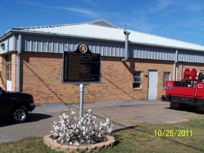
Location. 34° 4.894′ N, 86° 35.473′ W. Marker is in Blountsville, Alabama, in Blount County. Marker is on Lee Street (County Road 26), on the right when traveling west. Touch for map. Marker is in this post office area: Blountsville AL 35031, United States of America. Touch for directions.
Other nearby markers. At least 8 other markers are within 7 miles of this marker, measured as the crow flies. In Honor of Those Who Served (a few steps from this marker); Blountsville (a few steps from this marker); Ebenezer Hearn 1794-1862 (about 700 feet away, measured in a direct line); Federal Raid (approx. 1˝ miles away); Battle Royal (approx. 5.7 miles away); Exploit of Murphree Sisters (approx. 5.7 miles away); First Baptist Church Holly Pond (approx. 6.6 miles away); The History of Holly Pond School (approx. 6.8 miles away). Touch for a list and map of all markers in Blountsville.
Credits. This page was last revised on June 16, 2016. It was originally submitted on November 5, 2011, by David J Gaines of Pinson, Alabama. This page has been viewed 1,743 times since then and 56 times this year. Photos: 1, 2. submitted on November 5, 2011, by David J Gaines of Pinson, Alabama. • Craig Swain was the editor who published this page.

