Santa Barbara in Santa Barbara County, California — The American West (Pacific Coastal)
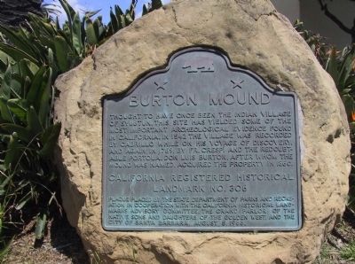
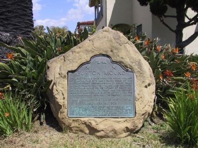
Burton Mound
Erected 1966 by the State of California, the Native Sons and Daughters of the Golden West, and the City of Santa Barbara. (Marker Number 306.)
Topics and series. This historical marker is listed in these topic lists: Anthropology & Archaeology • Native Americans. In addition, it is included in the California Historical Landmarks, and the Portolá Expedition series lists.
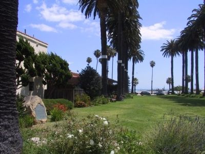
Location. 34° 24.659′ N, 119° 41.526′ W. Marker is in Santa Barbara, California, in Santa Barbara County. Marker is on West Mason Street, on the right when traveling north. Marker is located at the north end of Ambassador Park. Touch for map. Marker is at or near this postal address: 129 West Mason Street, Santa Barbara CA 93101, United States of America. Touch for directions.
Other nearby markers. At least 8 other markers are within walking distance of this marker. Santa Barbara Veterans' Memorial Building (about 300 feet away, measured in a direct line); Sambo's Birthplace (about 400 feet away); Burton’s Mound (about 400 feet away); Santa Barbara's First People (about 500 feet away); Fly To-Day (approx. 0.2 miles away); Santa Barbara Railroad Station (approx. 0.2 miles away); Private Railcar Spurs (approx. 0.2 miles away); Bridge MP 36729 Santa Barbara Subdivision (approx. 0.2 miles away). Touch for a list and map of all markers in Santa Barbara.
Regarding Burton Mound. This site was one of the largest Chumash villages on the coast. Portolá stated that at least 600 people lived here when he visited in 1769. The Santa Barbara Mission was founded in 1786, and the village had disappeared by the early 1830s. In 1923, archaeologist John P. Harrington excavated the property on behalf of the Smithsonian Institution. Over 2,500 objects were uncovered, which are now at the National Museum of the American Indian. This site was declared a California Historical Landmark in 1939, and the marker placed here in 1966.
Related marker. Click here for another marker that is related to this marker. - Burton’s Mound, another marker nearby.
Additional keywords. Chumash, Native American, John P. Harrington, Smithsonian,
Credits. This page was last revised on November 11, 2023. It was originally submitted on December 16, 2011, by Michael Kindig of Elk Grove, California. This page has been viewed 1,415 times since then and 85 times this year. Last updated on August 4, 2019, by Craig Baker of Sylmar, California. Photos: 1, 2, 3. submitted on December 16, 2011, by Michael Kindig of Elk Grove, California. • Bill Pfingsten was the editor who published this page.


