Downtown Las Vegas in Clark County, Nevada — The American Mountains (Southwest)
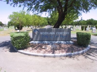
Woodlawn Cemetery
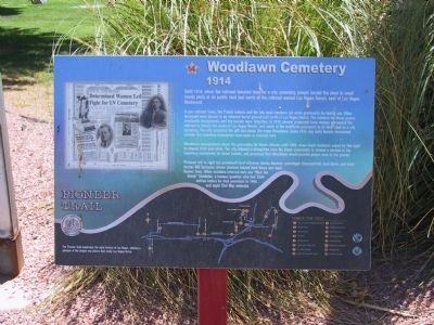
1914
In pre-railroad times, the Paiute Indians and the few local ranchers set aside graveyards for family use. Other deceased were placed in an informal burial ground just north of Las Vegas Ranch. The markers for these graces eventually disappeared, and the burials were forgotten. In 1914, several prominent local women persuaded the railroad to donate ten acres of Las Vegas Ranch, just south of the unofficial graveyard, to be dedicated as a city cemetery. The city accepted the gift and chose the name Woodlawn. Since 1914, any early burials discovered outside the cemetery boundaries have been re-interred here.
Woodlawn management chose the gravestones for black citizens until 1939, when black residents asked for the right to choose their own plots. The city allowed a delegation from the black community to choose a section of the cemetery exclusively for black burials, and promised that Woodlawn would provide proper care of the graves.
Pictured left to right are prominent local attorney Harley Harmon, gunslinger Diamondfield Jack Davis, and local farmer Bill Tomiyasu whose produce helped feed those who built Hoover Dam. Other notables interred here are "Nick the Greek" Daneolos, a famous gambler who lost $500 million before he died penniless in 1964, and eight Civil War veterans.
Erected by the City of Las Vegas, Clark County, Preserve America & the Southern Nevada Public Lands Management Act. (Marker Number 14.)
Topics. This historical marker is listed in these topic lists: African Americans • Cemeteries & Burial Sites • Native Americans • Settlements & Settlers. A significant historical year for this entry is 1914.
Location. 36° 11.199′ N, 115° 8.017′ W. Marker is in Las Vegas, Nevada, in Clark County. It is in Downtown Las Vegas. Marker is at the intersection of North Las Vegas Boulevard and Foremaster Lane on North Las Vegas Boulevard. Touch for map. Marker is at or near this postal address: 1500 North Las Vegas Boulevard, Las Vegas NV 89101, United States of America. Touch for directions.
Other nearby markers. At least 8 other markers are within walking distance of this marker. A different marker also named Woodlawn Cemetery (about 300 feet away, measured in a direct line); Las Vegas Paiute Colony (approx. 0.3 miles away); First Las Vegas Post Office (approx. 0.4 miles away); Old Mormon Fort (approx. 0.4 miles away); Helen Jane Wiser Stewart (approx. 0.4 miles away); Las Vegas Fort (approx. 0.4 miles away); The Las Vegas Mormon Fort (approx. 0.4 miles away); Las Vegas Old Mormon Fort (approx. 0.4 miles away). Touch for a list and map of all markers in Las Vegas.
Related markers. Click here for a list of markers that are related to this marker. The Pioneer Trail - West Las Vegas
Also see . . . Woodlawn Cemetery page on www.LasVegasPioneerTrail.com. Visit the www.LasVegasPioneerTrail.com to learn more about the Woodlawn Cemetery. (Submitted on October 31, 2020, by Deuce Brandt of North Las Vegas, Nevada.)
Credits. This page was last revised on February 7, 2023. It was originally submitted on December 8, 2011, by Michael Kindig of Elk Grove, California. This page has been viewed 916 times since then and 31 times this year. Last updated on December 28, 2011, by Michael Kindig of Elk Grove, California. Photos: 1, 2, 3. submitted on December 8, 2011, by Michael Kindig of Elk Grove, California. • Syd Whittle was the editor who published this page.


