West Pikeland Township near Chester Springs in Chester County, Pennsylvania — The American Northeast (Mid-Atlantic)
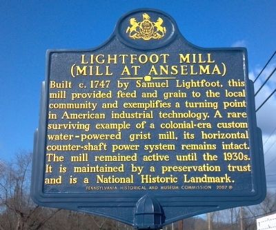
Lightfoot Mill
Mill at Anselma
Built c.1747 by Samuel Lightfoot, this mill provided feed and grain to the local community and exemplifies a turning point in American industrial technology. A rare surviving example of a colonial-era custom water-powered grist mill, its horizontal counter-shaft power system remains intact. The mill remained active until the 1930s. It is maintained by a preservation trust and is a National Historic Landmark.
Erected 2007 by Pennsylvania Historical & Museum Commission.
Topics and series. This historical marker is listed in these topic lists: Agriculture • Colonial Era • Industry & Commerce • Settlements & Settlers. In addition, it is included in the National Historic Landmarks, and the Pennsylvania Historical and Museum Commission series lists. A significant historical year for this entry is 1747.
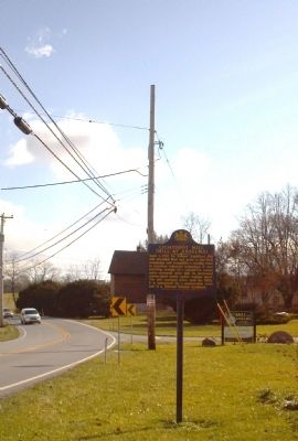
Location. 40° 4.952′ N, 75° 38.579′ W. Marker is near Chester Springs, Pennsylvania, in Chester County. It is in West Pikeland Township. Marker is on Conestoga Road (Route 401). Touch for map. Marker is at or near this postal address: 1730 Conestoga Road, Chester Springs PA 19425, United States of America. Touch for directions.
Other nearby markers. At least 8 other markers are within 6 miles of this marker, measured as the crow flies. Chester Springs (approx. 1.6 miles away); a different marker also named Chester Springs (approx. 1.6 miles away); Good News Productions (approx. 1.7 miles away); Weaver’s Cottage (approx. 3.4 miles away); Battle of the Clouds (approx. 4½ miles away); Graceanna Lewis (approx. 4.9 miles away); a different marker also named The Battle of the Clouds (approx. 5.3 miles away); Edward Hunter Homestead (approx. 5.4 miles away). Touch for a list and map of all markers in Chester Springs.
Also see . . .
1. Lightfoot Mill - Wikipedia. (Submitted on January 4, 2012, by Keith S Smith of West Chester, Pennsylvania.)
2. Explore PA History – Behind the Marker. (Submitted on January 4, 2012, by Keith S Smith of West Chester, Pennsylvania.)
3. Lightfoot Genealogy. (Submitted on January 4, 2012, by Keith S Smith of West Chester, Pennsylvania.)
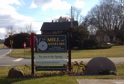
4. The Mill at Anselma. (Submitted on January 7, 2012, by Keith S Smith of West Chester, Pennsylvania.)
Additional commentary.
1. Early Chester County Mills:
By the mid-eighteenth century, southeastern Pennsylvania was exporting an ever increasing volume of wheat and flour to Britain. In 1747 Pikeland Township in Chester County boasted more than fifty independent farms, but not a grist mill. Recognizing this as an opportunity, surveyor and Justice of the Peace, Samuel Lightfoot constructed a small mill on the banks of the Pickering Creek. Today, the Mill at Anselma is the nation's best surviving example of a water-powered custom grist mill. Lightfoots mill, was not the largest mill in the region, or even the most valuable, the Anselma mill was typical of the approximately 100 grist mills that operated throughout Chester County in the late 1700’s. Like other custom mills, it served the local farmers who brought their grain to have it ground for their family’s own use.
Merchant mills operated somewhat differently, they purchased grain from the farmers, ground it, and sold the flour themselves. The Mill at Anselma never aspired to far-reaching trade, it was built to serve the community.
— Submitted January 4, 2012, by Keith S Smith of West Chester, Pennsylvania.
Credits. This page was last revised on February 7, 2023. It was originally submitted on January 4, 2012, by Keith S Smith of West Chester, Pennsylvania. This page has been viewed 1,083 times since then and 32 times this year. Photos: 1, 2, 3. submitted on January 4, 2012, by Keith S Smith of West Chester, Pennsylvania. • Bill Pfingsten was the editor who published this page.


