Fort Myer in Arlington in Arlington County, Virginia — The American South (Mid-Atlantic)
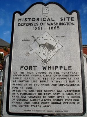
Fort Whipple
Historical Site
— Defenses of Washington 1861 - 1865 —
Erected 1965 by Arlington County, Virginia. (Marker Number 12.)
Topics and series. This historical marker is listed in these topic lists: Forts and Castles • War, US Civil. In addition, it is included in the Defenses of Washington series list. A significant historical year for this entry is 1863.
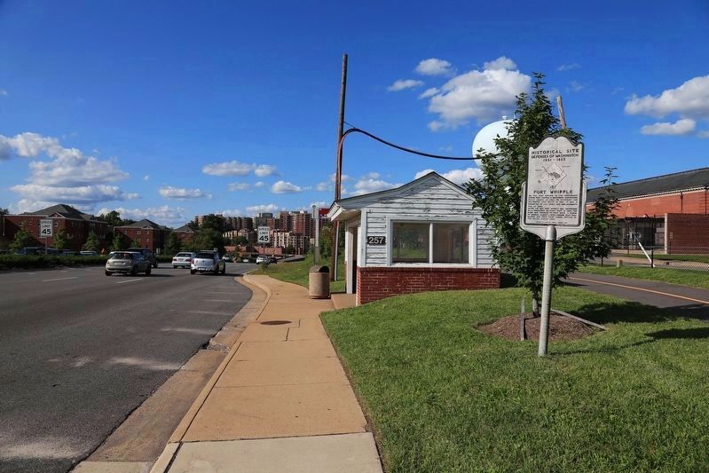
Location. 38° 52.895′ N, 77° 5.043′ W. Marker is in Arlington, Virginia, in Arlington County. It is in Fort Myer. Marker is at the intersection of Arlington Boulevard (U.S. 50) and North Pershing Drive, on the right when traveling east on Arlington Boulevard. Marker is near the entrance to Fort Myer at North Pershing Drive. There is a pull-off at this marker. Touch for map. Marker is in this post office area: Arlington VA 22204, United States of America. Touch for directions.
Other nearby markers. At least 8 other markers are within walking distance of this marker. World’s First Public Passenger Flight (within shouting distance of this marker); Orville Wright’s First Virginia Flight (within shouting distance of this marker); 12th Pennsylvania Volunteer Infantry (about 300 feet away, measured in a direct line); Fort Myer Historic District (about 400 feet away); The Commander in Chief's Oak (about 400 feet away); Thomas Etholen Selfridge (about 500 feet away); Centennial of Military Aviation (about 500 feet away); Famous Firsts in Aeronautics at Fort Myer (about 500 feet away). Touch for a list and map of all markers in Arlington.
More about this marker. In the center of the marker is a map of the Washington Defenses, with an arrow pointing out the location of Fort Whipple.
Additional commentary.
1. Fort Whipple Particulars
From "Mr. Lincoln's Forts: A Guide to the Civil War Defenses of Washington," by Benjamin Franklin Cooling III and Walton H. Owen II:
The fort was named for Maj. Gen. Amiel Weeks Whipple who died of wounds received at the battle of Chancellorsville. The original works stood at the corner of Jackson and Grant Avenues (in front of Quarters No. 6) on Fort Myer. The fort
was described as a "bastioned quadrelateral work." It supported the line of smaller lunettes that extended along Arlington Heights.
The fort had a perimeter of 658 yards with positions for 43 guns. The inner structures included two magazines, two filling rooms, and several bomb-proofs. Quartermaster buildings stood behind the fort. Armament included four 12-pdr howitzers, six 12-pdr Napoleon guns, eleven 4.5-in siege rifles, and eight 12-pdr guns.
Units that garrisoned the fort during the war at different times included the 1st and 3rd Massachusetts Heavy Artillery, 145th Ohio Infantry, 10th New York Heavy Artillery, Company K - 1st New York Artillery, Company D - Maryland Light Artillery, Company C - 4th US Artillery, 2nd Connecticut Heavy Artillery, and Independent Battery I of the Pennsylvania Light Artillery.
— Submitted February 4, 2008, by Craig Swain of Leesburg, Virginia.

Library of Congress
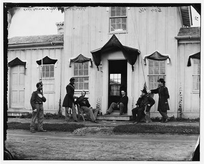
3. Headquarters Building at Fort Whipple
Officers posing in front of the headquarters building at Fort Whipple. The fort was among the most extensive built on the Virginia side to defend the capital. (Library of Congress: Civil War photographs, 1861-1865 / compiled by Hirst D. Milhollen and Donald H. Mugridge, Washington, D.C. : Library of Congress, 1977. No. 0766)
Credits. This page was last revised on February 1, 2023. It was originally submitted on February 3, 2008. This page has been viewed 3,587 times since then and 96 times this year. Photos: 1. submitted on February 3, 2008. 2. submitted on September 10, 2017, by J. J. Prats of Powell, Ohio. 3. submitted on February 4, 2008, by Craig Swain of Leesburg, Virginia. 4. submitted on September 18, 2015, by J. Makali Bruton of Accra, Ghana. • Craig Swain was the editor who published this page.
Editor’s want-list for this marker. Photo of the site of Fort Whipple and the Gen. Myer monument there. • Can you help?


