Marker Logo HMdb.org THE HISTORICAL
MARKER DATABASE
“Bite-Size Bits of Local, National, and Global History”
Niagara-on-the-Lake in Niagara Region, Ontario — Central Canada (North America)
 

Fort Niagara


Fort Niagara Marker image. Click for full size.
Photographed By Dale K. Benington, July 27, 2011
1. Fort Niagara Marker
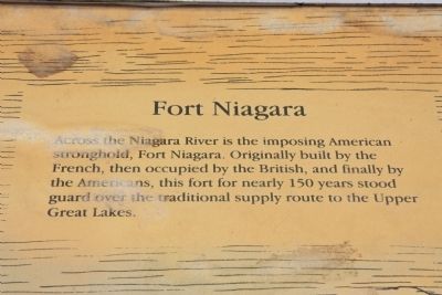
Inscription. Across the Niagara River is the imposing American stronghold, Fort Niagara. Originally built by the French, then occupied by the British, and finally by the Americans, this fort for nearly 150 years stood guard over the traditional supply route to the Upper Great Lakes.
 
Erected by Parks Canada.
 
Topics. This historical marker is listed in these topic lists: Forts and CastlesWar of 1812War, French and IndianWar, US Revolutionary.
 
Location. 43° 15.127′ N, 79° 3.732′ W. Marker is in Niagara-on-the-Lake, Ontario, in Niagara Region. Marker can be reached from Queens Parade just south of Wellington Street. This historic marker is located on the grounds of a national historic park. On the map this historic marker appears to be near the end of Bryon Street, but in order to see this historic marker one should probably pull into the parking lot of the national park, which is just off of the roadway called the Queens Parade. Once you park your vehicle the historical marker is just a short walk away along the pathway that leads to the fort's visitor center. This particular historical marker is part of a three marker display panel that is situated between the park's visitor center
Paid Advertisement
Click on the ad for more information.
Please report objectionable advertising to the Editor.
Click or scan to see
this page online
and the reconstructed fort, facing away from Fort George and towards Fort Niagara (situated on the American side of the river). Touch for map. Marker is in this post office area: Niagara-on-the-Lake ON L0S 1J0, Canada. Touch for directions.
 
Other nearby markers. At least 8 other markers are within walking distance of this marker. A Strategic Site (here, next to this marker); a different marker also named Fort Niagara (here, next to this marker); The Battle of Fort George (here, next to this marker); a different marker also named A Strategic Site (a few steps from this marker); The Fortified Mouth of the Niagara River (a few steps from this marker); Sir Isaac Brock's First Burial Site (within shouting distance of this marker); Fort George (within shouting distance of this marker); Six Pounder Field Gun (about 90 meters away, measured in a direct line). Touch for a list and map of all markers in Niagara-on-the-Lake.
 
Fort Niagara Marker image. Click for full size.
Photographed By Dale K. Benington, July 27, 2011
2. Fort Niagara Marker
Close-up view of the text, as seen on the weathered display panel.
Fort Niagara Marker image. Click for full size.
Photographed By Dale K. Benington, July 27, 2011
3. Fort Niagara Marker
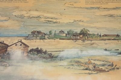
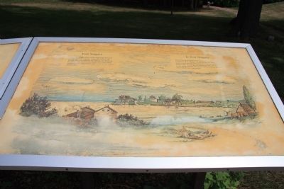
Close-up view of the illustration on the historical marker showing Fort Niagara on the opposite (American) side of the Niagara River, as seen from the Canadian side of the river.
Fort Niagara Marker image. Click for full size.
Photographed By Dale K. Benington, July 27, 2011
4. Fort Niagara Marker
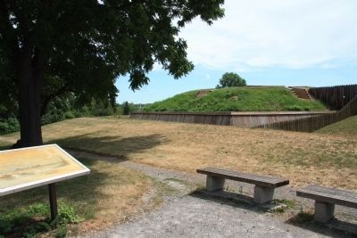
View of the historical marker in the left foreground and the Fort George northeast bastion (the Brock Bastion) in the right/center background of the picture.
Fort Niagara Marker image. Click for full size.
Photographed By Dale K. Benington, July 27, 2011
5. Fort Niagara Marker
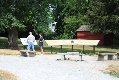
View of the display panel that is situated just outside of Fort George, with a distant view of Fort Niagara (on the American side of the Niagara River) seen through the opening in the trees, in front of the display panel.
Fort Niagara image. Click for full size.
Photographed By Dale K. Benington, July 27, 2011
6. Fort Niagara
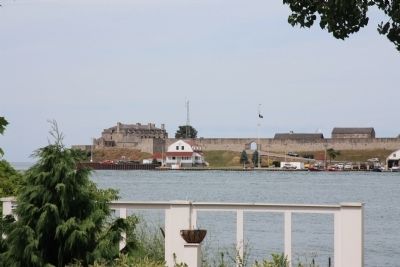
View of Fort Niagara as seen from across the Niagara River, from the Canadian side of the river.
 
 
Credits. This page was last revised on September 27, 2019. It was originally submitted on March 17, 2012, by Dale K. Benington of Toledo, Ohio. This page has been viewed 741 times since then and 12 times this year. Photos:   1, 2, 3, 4, 5, 6. submitted on March 29, 2012, by Dale K. Benington of Toledo, Ohio.
Share this page.  
Share on Tumblr
m=53630

CeraNet Cloud Computing sponsors the Historical Marker Database.
This website earns income from purchases you make after using our links to Amazon.com. We appreciate your support.
Paid Advertisement
May. 10, 2024