Sedona in Coconino County, Arizona — The American Mountains (Southwest)
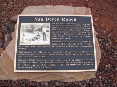
Van Deren Ranch
Lee Van Deren, cattleman, arrived to put his children in the new Sedona school opened in 1910. Ranching was a major part of Sedona’s early economy. Round ups and cattle drives were a twice a year occurrence for ranchers when moving their herds from winter to summer grazing allotments.
About 1924, Lee’s son, Earl, bought 40 acres along the west side of this road and with hard work soon paid off the property and became a successful rancher.
Earl occasionally added to his income by fighting fires for the Forest Service and providing cattle, horses and wagons for use in movies being made in and around Sedona.
But after WWII, Earl saw Sedona changing with an influx of tourists and new residents. He could see the end of ranching as he knew it so he sold out and moved to Montana. The first street west of here is named for the Van Deren Family.
Topics. This historical marker is listed in these topic lists: Agriculture • Animals • Industry & Commerce • Settlements & Settlers. A significant historical year for this entry is 1910.
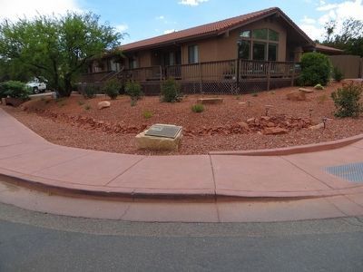
Location. 34° 52.563′ N, 111° 45.669′ W. Marker is in Sedona, Arizona, in Coconino County. Marker is at the intersection of Jordan Road and Navahopi Road, on the right when traveling south on Jordan Road. Touch for map. Marker is at or near this postal address: 597 Jordan Road, Sedona AZ 86336, United States of America. Touch for directions.
Other nearby markers. At least 8 other markers are within walking distance of this marker. Orchards (1890 - 1970) (about 500 feet away, measured in a direct line); Jordan Farmhouse (approx. 0.2 miles away); Fruit Packing House (approx. 0.2 miles away); Jordan Tractor Shed (approx. 0.2 miles away); Jordan Sales Building (approx. 0.3 miles away); Rollie's Camera (approx. 0.4 miles away); Carl Richards' Garage (approx. 0.4 miles away); The Sinagua (approx. 0.6 miles away). Touch for a list and map of all markers in Sedona.
Also see . . . Van Deren Family History. Open A Ranch Website entry (Submitted on March 18, 2021, by Larry Gertner of New York, New York.)
Credits. This page was last revised on March 18, 2021. It was originally submitted on April 8, 2012, by Denise Boose of Tehachapi, California. This page has been viewed 1,095 times since then and 76 times this year. Photos: 1. submitted on April 8, 2012, by Denise Boose of Tehachapi, California. 2. submitted on May 24, 2016, by Bill Kirchner of Tucson, Arizona. • Syd Whittle was the editor who published this page.

