Near Olustee in Baker County, Florida — The American South (South Atlantic)
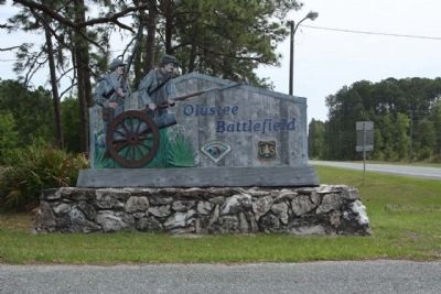
Olustee Battlefield
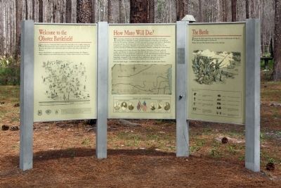
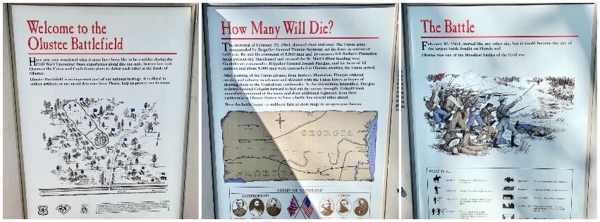
(Left Panel)
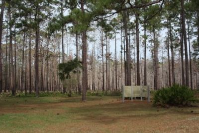
Welcome to the Olustee Battlefield
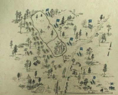
Battlefield Map included with Park rules and regulations
(Center Panel)
How Many Would Die ?
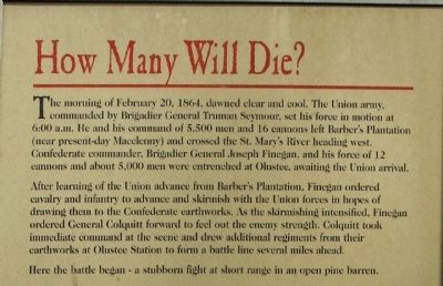
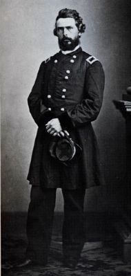
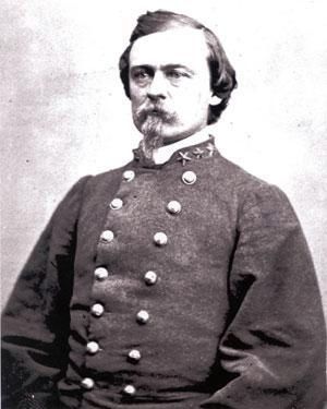
The morning of February 20, 1864, dawned clear and cool. The Union army, commanded by Brigadier General Truman Seymour, set his force into motion at 6:00 a.m. He and his command of 5,500 men and 16 cannons left Barber's Plantation (near present-day Macclenny) and crossed the St. Mary's River heading west. Confederate commander, Brigadier General Joseph Finegan and his force of 12 cannons and about 5,000 men were entrenched at Olustee, awaiting the Union arrival.
After learning of the Union advance from Barber's Plantation, Finegan ordered cavalry and infantry to advance and skirmish with the Union forces in hopes of drawing them to the Confederate earthworks. As the skirmishing intensified, Finegan ordered General Colquitt forward to feel out the enemy strength. Colquitt took immediate command at the scene and drew additional regiments from their earthworks at Olustee Station to form a battle line several miles ahead.
Here the battle began - a stubborn fight at short range in an open pine barren.
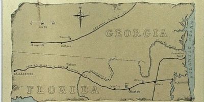
(Map and Chain of Command Picture included)
(Right Panel)
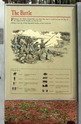
The Battle
February 20, 1864, started like any other day, but it would become the day of the largest battle fought on Florida soil.
Olustee was one of the bloodiest battles of the Civil War.
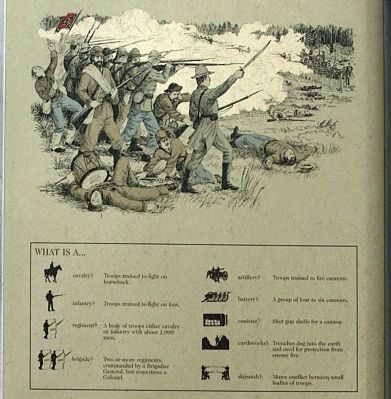
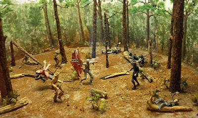
(Drawing included with battlefield component explanation)
Erected by US Park Service, Florida Park Service, Olustee Battlefield.
Topics. This historical marker is listed in this topic list: War, US Civil. A significant historical date for this entry is February 20, 1786.
Location. 30° 12.854′ N, 82° 23.36′ W. Marker is near Olustee, Florida, in Baker County. Marker is on Battlefield Trail, on the left when traveling north. Located on Battlefield Trail (17 Mile Camp Road) 0.3 miles north of U.S. 90. Touch for map. Marker is at or near this postal address: 5815 Battlefield Trail, Sanderson FL 32087, United States of America. Touch for directions.
Other nearby markers. At least 8 other markers are within walking distance of this marker. The Yankees are Coming (within shouting distance of this marker); Brig. Gen. Joseph Finegan (about 300 feet away, measured in a direct line); The Battle of Olustee (about 300 feet away); Battle of Ocean Pond (or The Battle of Olustee) (about 300 feet away); A Legacy Remembered (about 500 feet away); Fight or Die (about 600 feet away); Battle of Olustee Union Memorial (about 800 feet away); Cries and Cheers (about 800 feet away). Touch for a list and map of all markers in Olustee.
Also see . . .
1. Florida State Parks- Olustee Battlefield Historic State Park. This park commemorates the site of Florida's largest Civil War battle (Submitted on April 28, 2012, by Mike Stroud of Bluffton, South Carolina.)
2. Battle of Olustee, from Wikipedia. The Union losses caused Northern authorities to question the necessity of further Union involvement in the militarily insignificant state of Florida. (Submitted on April 28, 2012, by Mike Stroud of Bluffton, South Carolina.)
3. Annual Reenactment. On one weekend every February , thousands of reenactors from across the U.S. and even from overseas, come to the Park to reenact the Battle of Olustee. (Submitted on April 28, 2012, by Mike Stroud of Bluffton, South Carolina.)
Additional commentary.
1. Olustee Battlefield
The reenactment of the Battle of Olustee is co-sponsored by four organizations: the Olustee Battlefield Historic State Park Citizens Support Organization; the Florida Department of Environmental Protection - Recreation and Parks; the USDA Forest Service - Osceola National Forest; and The Blue-Grey Army, Inc.
— Submitted April 28, 2012, by Mike Stroud of Bluffton, South Carolina.
2. National Register of Historic Places:
★ Olustee Battlefield (added 1970 - - #70000177)
Also known as Battle of Ocean Pond
2 mi. E of Olustee on U.S. 90 in Osceola National Forest , Olustee
♦ Historic Significance: Event
♦ Area of Significance: Military
♦ Period of Significance: 1850-1874
♦ Owner: Federal
♦ Historic Function: Defense
♦ Historic Sub-function: Battle Site
♦ Current Function: Landscape, Recreation And Culture
♦ Current Sub-function: Museum, Park
— Submitted April 28, 2012, by Mike Stroud of Bluffton, South Carolina.
Photographed By Olustee Battlefield Visitor Center, `
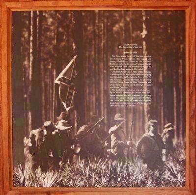
14. Olustee Battlefield
The Beginning of the End
February 1864
General Grant's Union Army of the Potomac is waiting for the spring thaw before charging into General Lee's Confederate Army of Northern Virginia. General Sherman is amassing 100,000 Union troops in West Tennessee and preparing for a fiery march through Georgia and South Carolina.
The Confederate states are now relaying heavily on Florida's farmers to furnish beef, pork, beans, potatoes, and salt to sustain its military forces. The Union's attempt to restore Florida to the Union and to cut off these vital supplies, leads here on the afternoon of February 20, 1864, to the Battle of Olustee.
Credits. This page was last revised on March 17, 2022. It was originally submitted on April 28, 2012, by Mike Stroud of Bluffton, South Carolina. This page has been viewed 1,886 times since then and 59 times this year. Photos: 1, 2, 3, 4, 5, 6, 7, 8, 9, 10, 11, 12, 13, 14, 15. submitted on April 28, 2012, by Mike Stroud of Bluffton, South Carolina. 16. submitted on March 8, 2020, by Mark Hilton of Montgomery, Alabama.
