Near Sharpsburg in Washington County, Maryland — The American Northeast (Mid-Atlantic)
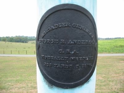
Brigadier General George B. Anderson
George B. Anderson
C.S.A.
mortally wounded
235 yards S. SW.
Topics. This historical marker is listed in this topic list: War, US Civil.
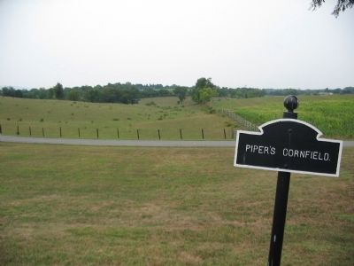
Location. 39° 28.224′ N, 77° 44.298′ W. Marker is near Sharpsburg, Maryland, in Washington County. Marker is on Richardson Avenue, on the left when traveling east. Touch for map. Marker is in this post office area: Sharpsburg MD 21782, United States of America. Touch for directions.
Other nearby markers. At least 8 other markers are within walking distance of this marker. Jackson's Command (a few steps from this marker); 132nd Pennsylvania Volunteer Infantry (within shouting distance of this marker); Anderson’s Division, Longstreet’s Command (within shouting distance of this marker); Richardson's Division, Second Army Corps (within shouting distance of this marker); Second Army Corps (about 300 feet away, measured in a direct line); a different marker also named Second Army Corps (about 300 feet away); a different marker also named Second Army Corps (about 300 feet away); 2nd Delaware (about 300 feet away). Touch for a list and map of all markers in Sharpsburg.
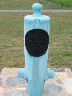
More about this marker. Marker is mounted on a Model 1857 12-pounder Light Field Gun, also known as a "Napoleon."
Regarding Brigadier General George B. Anderson. This marker is included on the Sunken Road or Bloody Lane Virtual Tour by Markers, see the Virtual Tour link below to see the markers in sequence.
Also see . . .
1. Six Generals Killed at Antietam. The locations of six generals killed in the battle are marked by cannon with their muzzles mounted downward. General Anderson commanded a brigade of North Carolinians. He was wounded in the foot and evacuated. He eventually died of the wound on November 16, at Raleigh, North Carolina. (Submitted on February 18, 2008, by Craig Swain of Leesburg, Virginia.)
2. Brig. Gen. George Burgwyn Anderson. A brief biographical outline of General Anderson. (Submitted on February 18, 2008, by Craig Swain of Leesburg, Virginia.)
Photographed By Brian Scott
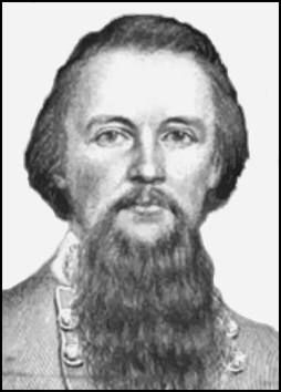
5. Brig. General George B. Anderson (1831-1862)
During the Battle of Antietam, Anderson's North Carolinians defended a portion of the Sunken Road (known as "Bloody Lane") against repeated Union attacks. A Minié ball struck Anderson near his ankle, injuring it badly. Anderson was transported to Shepherdstown and then by wagon up the Shenandoah Valley to Staunton, Virginia, to recuperate. He was eventually shipped by train to Raleigh, North Carolina, where he died following surgery to amputate the infected foot.
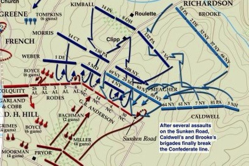
via American Battlefield Trust, unknown
6. Sunken Road or Bloody Lane Virtual Tour by Markers.
A collection of markers interpreting the action of during the Battle of Antietam around the Sunken Road.
(Submitted on February 23, 2008, by Craig Swain of Leesburg, Virginia.)
Click for more information.
(Submitted on February 23, 2008, by Craig Swain of Leesburg, Virginia.)
Click for more information.
Credits. This page was last revised on April 3, 2022. It was originally submitted on February 18, 2008, by Craig Swain of Leesburg, Virginia. This page has been viewed 1,574 times since then and 21 times this year. Photos: 1, 2, 3, 4. submitted on February 18, 2008, by Craig Swain of Leesburg, Virginia. 5. submitted on September 27, 2015, by Brian Scott of Anderson, South Carolina. 6. submitted on April 3, 2022, by Larry Gertner of New York, New York.
