Cherrydale in Arlington in Arlington County, Virginia — The American South (Mid-Atlantic)
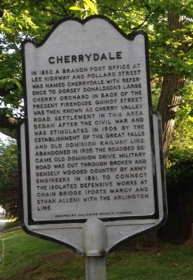
Cherrydale

Photographed By Kevin Vincent, April 29, 2012
1. Cherrydale
This neighborhood is on the National Register of Historic Places. The historic district is roughly bounded by Lorcom Lane between North Monroe Street and Military Road, Interstate 66, North Utah and North Taylor Streets south of Old Dominion Drive.
Erected by Arlington County, Virginia.
Topics. This historical marker is listed in these topic lists: Railroads & Streetcars • Roads & Vehicles • Settlements & Settlers • War, US Civil. A significant historical year for this entry is 1893.
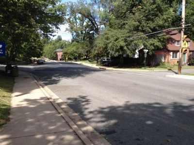
Location. 38° 53.93′ N, 77° 6.53′ W. Marker is in Arlington, Virginia, in Arlington County. It is in Cherrydale. Marker is on Military Road, on the right when traveling south. This marker is located in front of the Cherrydale public library. Touch for map. Marker is at or near this postal address: 2190 Military Road, Arlington VA 22207, United States of America. Touch for directions.
Other nearby markers. At least 8 other markers are within walking distance of this marker. Cherrydale Volunteer Firehouse (approx. 0.2 miles away); Taking Action: Michael Jones, Gloria Thompson, Ronald Deskins, Lance Newman (approx. 0.2 miles away); Taking Action: Barbara Johns (approx. 0.2 miles away); Taking Action: E. Leslie Hamm, Jr. (approx. 0.2 miles away); Take Action! (approx. 0.2 miles away); Cherrydale Drug Fair Sit-In (approx. 0.2 miles away); Taking Action: Dorothy M. Bigelow Hamm (approx. 0.2 miles away); Cherrydale Masonic Hall (approx. 0.2 miles away). Touch for a list and map of all markers in Arlington.
Additional commentary.
1.
Note To Editor only visible by Contributor and editor
— Submitted May 28, 2012, by Kevin Vincent of Arlington, Virginia.
Credits. This page was last revised on February 1, 2023. It was originally submitted on May 28, 2012, by Kevin Vincent of Arlington, Virginia. This page has been viewed 668 times since then and 32 times this year. Photos: 1. submitted on May 28, 2012, by Kevin Vincent of Arlington, Virginia. 2, 3. submitted on September 23, 2012, by Craig Swain of Leesburg, Virginia. • Craig Swain was the editor who published this page.

