West Friendship in Howard County, Maryland — The American Northeast (Mid-Atlantic)
Moving Goods on the National Road
— The Historic National Road - The Road That Built The Nation —
Inscription.
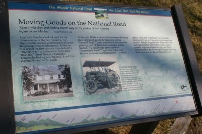
“Open a wide door, and make a smooth way for the produce of that Country to pass to our Markets.” George Washington, 1784
America’s founders looked west for the future success of the new country. The United States needed good roads and canals to open up frontier settlements. Baltimore was one of the first eastern cities to build a “smooth way” to the interior. Soon after 1800, this “Great Western Turnpike” became the first leg of a National Road that eventually reached St. Louis.
By the mid 1830s, western farmers were shipping their crops and goods to Baltimore on the National Road. There, local merchants used the growing port of Baltimore to reach a world market. The result was a revolution in “community-based” agriculture that soon became national and international. Livestock, grains, fruits and vegetables were linked to customers by an ever improving transportation system. Freight wagons were followed by the railroad, then the automobile. Today’s ever present eighteen-wheeled trucks are direct descendants of the Conestoga Wagons pulled by six-horse teams on the old National Road.
Erected by America's Byways.
Topics and series. This historical marker is listed in these topic lists: Agriculture • Industry & Commerce • Roads & Vehicles. In addition, it is included in the The Historic National Road series list. A significant historical year for this entry is 1784.
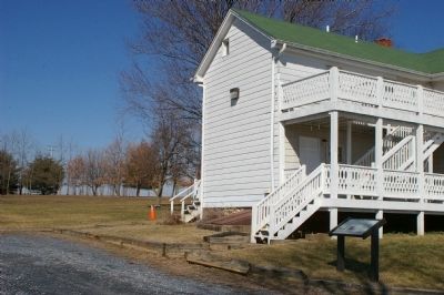
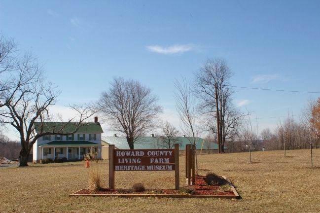
Location. 39° 18.3′ N, 76° 57.891′ W. Marker is in West Friendship, Maryland, in Howard County. Marker can be reached from Frederick Road (Maryland Route 144), on the left when traveling west. This marker is located within the grounds of the Howard County Living Farm Heritage Museum. It is just behind the house. Touch for map. Marker is at or near this postal address: 12985 Frederick Road, West Friendship, Maryland, West Friendship MD 21794, United States of America. Touch for directions.
Other nearby markers. At least 8 other markers are within 4 miles of this marker, measured as the crow flies. Simpson & Mount Gregory United Methodist Churches (approx. 3 miles away); Mount Gregory United Methodist Church Bell (approx. 3 miles away); Dr. Charles Alexander Warfield (approx. 3 miles away); Cooksville High School (approx. 3 miles away); Cooksville (approx. 3.1 miles away); a different marker also named Cooksville (approx. 3.1 miles away); Gettysburg Campaign (approx. 3.1 miles away); Roberts Inn (approx. 3.1 miles away).
More about this marker. On the lower left is a photo of the Hebb House dating to the early 20th century.
On the lower right is a photo showing, Local farmer Thomas Selby is seen here in front of a 24-45 Case Tractor in 1954. In order to avoid the expense of having to buy their own equipment, farmers often hired custom threshers at harvest time. This 1926 tractor was used until 1958 by Mr. Edward R. Frank, Sr., who traveled to farms throughout Howard County, including this one, to thresh grain for farmers.
The background of the marker is "National Road at Fairview Inn" which is the standard for markers in this series. An elevation diagram of the national road is displayed on the bottom of the marker's face.
Also see . . .
1. The National Road – First Highway in America. Legends of America website entry (Submitted on March 12, 2022, by Larry Gertner of New York, New York.)
2. The Howard County Living Farm Heritage Museum. Museum website homepage (Submitted on March 13, 2022, by Larry Gertner of New York, New York.)
Credits. This page was last revised on March 24, 2024. It was originally submitted on February 25, 2008, by Christopher Busta-Peck of Shaker Heights, Ohio. This page has been viewed 1,539 times since then and 17 times this year. Photos: 1, 2, 3. submitted on February 25, 2008, by Christopher Busta-Peck of Shaker Heights, Ohio. • Craig Swain was the editor who published this page.


