Marker Logo HMdb.org THE HISTORICAL
MARKER DATABASE
“Bite-Size Bits of Local, National, and Global History”
Caney in Montgomery County, Kansas — The American Midwest (Upper Plains)
 

Captain Richard C. Mason

PeaRidge Battlefield Arkansas 1862


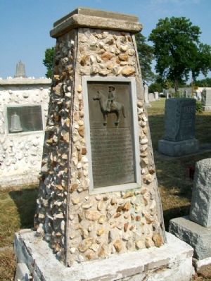
Captain Richard C. Mason Marker image. Click for full size.
Photographed By William Fischer, Jr., July 7, 2012
1. Captain Richard C. Mason Marker
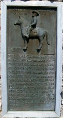
Inscription. Near this monument March 8, 1862, Captain Richard C. Mason of the 16th Arkansas Cavalry and was severly wounded and his horse killed. Mason was rescued by Frank Colbert a Chickasaw. Mason served for the duration of the war, and received an honorable discharge. He died July 27, 1897 at the Soldiers Home at Little Rock Arkansas, and is burried there in the Confederate Cemetry.
 
Topics. This memorial is listed in these topic lists: AnimalsNative AmericansWar, US Civil. A significant historical date for this entry is March 8, 1862.
 
Location. 37° 1.041′ N, 95° 55.773′ W. Marker is in Caney, Kansas, in Montgomery County. Marker is in Sunny Side Cemetery, along the main entrance road about 500 feet north of Taylor Avenue. McGee Street (US Hwy 75) runs along the eastern boundary of the cemetery. Touch for map. Marker is in this post office area: Caney KS 67333, United States of America. Touch for directions.
 
Other nearby markers. At least 8 other markers are within walking distance of this marker. Jappa Mason (here, next to this marker); Richard Colbert Mason (here, next to this marker); “Walking Stick” Cannon (about 600 feet away, measured in a direct line); Caney War Memorial (about 700 feet away); Black Dog Trail Campsite (approx. 0.4 miles away); George H. Wark 1878 - 1974 (approx. 0.4 miles away); World War Memorial
Paid Advertisement
Click on the ad for more information.
Please report objectionable advertising to the Editor.
Click or scan to see
this page online
(approx. 0.4 miles away); Bell's Trading Post and Village Water Well (approx. 0.6 miles away). Touch for a list and map of all markers in Caney.
 
Captain Richard C. Mason Monument image. Click for full size.
Photographed By William Fischer, Jr., July 7, 2012
2. Captain Richard C. Mason Monument
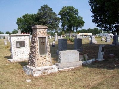
Captain Richard C. Mason Family Plot image. Click for full size.
Photographed By William Fischer, Jr., July 7, 2012
3. Captain Richard C. Mason Family Plot
Looking southeast, with McGee Street (US Hwy 75) in background
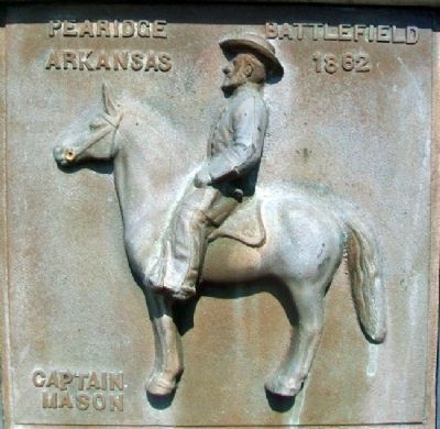
Captain Richard C. Mason Relief on Marker image. Click for full size.
Photographed By William Fischer, Jr., July 7, 2012
4. Captain Richard C. Mason Relief on Marker
 
 
Credits. This page was last revised on September 7, 2020. It was originally submitted on July 26, 2012, by William Fischer, Jr. of Scranton, Pennsylvania. This page has been viewed 748 times since then and 20 times this year. Photos:   1, 2, 3, 4. submitted on July 26, 2012, by William Fischer, Jr. of Scranton, Pennsylvania.
Share this page.  
Share on Tumblr
m=57880

CeraNet Cloud Computing sponsors the Historical Marker Database.
This website earns income from purchases you make after using our links to Amazon.com. We appreciate your support.
Paid Advertisement
Apr. 26, 2024