Keslers Cross Lanes in Nicholas County, West Virginia — The American South (Appalachia)
Kesslers Cross Lanes
"Battle of Knives and Forks"
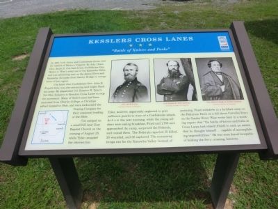
Cox knew that Confederate Gen. John B. Floyd’s force was also advancing and might flank his army. He dispatched Col. Erastus B. Tyler’s 7th Ohio Infantry to Kesslers Cross Lanes to stop the movement. Many of Tyler’s men had been recruited from Oberlin College, a Christian school located in Ohio, and were nicknamed the Praying Company for their continual reading of the Bible.
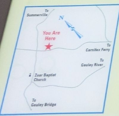
Cox camped on a small hill near Zoar Baptist Church on the evening of August 25, while Tyler occupied the intersection. Tyler, however, apparently neglected to post sufficient guards to warn of a Confederate attack. At 5 A.M. the next morning, while the young soldiers were eating breakfast, Floyd and 1,700 men approached the camp, surprised the Federals, and routed them. The Federals reported 15 killed, 20 wounded and 38 captured. The remaining troops ran for the Kanawha Valley. Instead of pursuing, Floyd withdrew to a fortified camp on the Patterson Farm on a hill above Carnifex Ferry on the Gauley River. Wise wrote later in a mocking report that the “battle of knives and forks at Cross Lanes had elated {Floyd} to such an extent, that he thought himself…capable of accomplishing impossibilities.” He was soon found incapable of holding the ferry crossing, however.
Erected by West Virginia Civil War Trails.
Topics and series. This historical marker is listed in this topic list: War, US Civil. In addition, it is included in the West Virginia Civil War Trails series list. A significant historical year for this entry is 1861.
Location. 38° 13.578′ N, 80° 55.938′ W. Marker is in Keslers Cross Lanes, West Virginia, in Nicholas County. Marker is on Summerville Lake Road (State Highway 129) 0.6 miles south of Whitewater Road (County Route 9), on the left when traveling south. Touch for map. Marker is at or near this postal address: 5536 Summersville Lake Road, Keslers Cross Lanes WV 26675, United States of America. Touch for directions.
Other nearby markers. At least 8 other markers are within 2 miles of this marker, measured as the crow flies. Fight At Ramsey’s Fort (approx. ¼ mile away); Cross Lanes Battle (approx. half a mile away); Keslers Cross Lanes / First County Court (approx. half a mile away); Zoar Baptist Church (approx. 0.7 miles away); Journey's End (approx. 1.2 miles away); Friendly Fire (approx. 1.2 miles away); "Follow Me My Men, Charge!" (approx. 1.2 miles away); The Battle of Carnifex Ferry (approx. 1.2 miles away). Touch for a list and map of all markers in Keslers Cross Lanes.
Credits. This page was last revised on June 16, 2016. It was originally submitted on September 5, 2012, by Don Morfe of Baltimore, Maryland. This page has been viewed 1,264 times since then and 57 times this year. Photos: 1. submitted on September 5, 2012, by Don Morfe of Baltimore, Maryland. 2. submitted on September 10, 2012, by Don Morfe of Baltimore, Maryland. 3. submitted on September 5, 2012, by Don Morfe of Baltimore, Maryland. • Craig Swain was the editor who published this page.


