Woodbridge in Prince William County, Virginia — The American South (Mid-Atlantic)
End of the Water
Belmont Bay
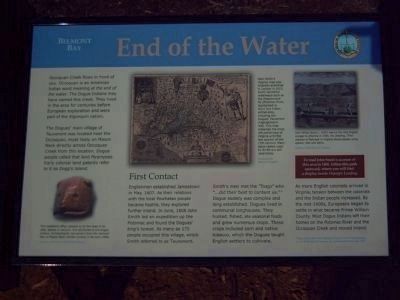
The Dogues’ main village of Tauxenent was located near the Occoquan, most likely on Mason Neck directly across Occoquan Creek from this location. Dogue people called that land Myampses. Early colonial land patents refer to it as Dogg’s Island.
First Contact
Englishmen established Jamestown in May, 1607. As their relations with the local Powhatan people became hostile, they explored further inland. In June, 1608 John Smith led an expedition up the Potomac and found the Dogues’ king’s howse. As many as 175 people occupied this village, which Smith referred to as Tauxenent. Smith’s men met the “Toags” who “…did their best to content us.”* Dogue society was complex and long established. Dogues lived in communal longhouses. They hunted, fished, ate seasonal foods and grew numerous crops. These crops included corn and native tobacco, which the Dogues taught English settlers to cultivate.
As more English colonists arrived in Virginia, tension between the colonists and the Indian people increased. By the mid-1600s, Europeans began to settle in what became Prince William County. Most Dogue Indians left their homes on the Potomac River and the Occoquan Creek and moved inland.
* From Captain John Smith’s History of Virginia, David Freeman Hawke, ed., the Bobbs-Merrill Company, Inc., Indianapolis & New York, 1970.
Erected 2007 by Prince William County.
Topics. This historical marker is listed in these topic lists: Colonial Era • Settlements & Settlers • Waterways & Vessels. A significant historical month for this entry is June 1608.
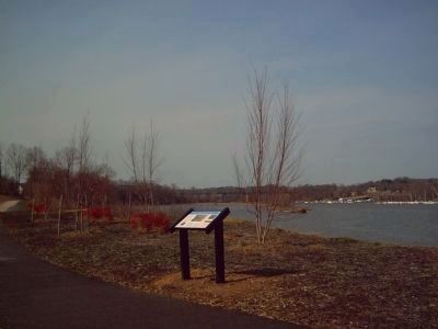
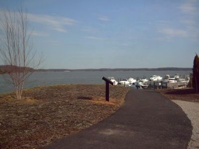
Location. 38° 39.405′ N, 77° 14.051′ W. Marker is in Woodbridge, Virginia, in Prince William County. Marker can be reached from Harbor Side Street east of Custis Street, on the right when traveling east. Marker is on a walking path, near the river. Touch for map. Marker is at or near this postal address: 530 Harbor Side Street, Woodbridge VA 22191, United States of America. Touch for directions.
Other nearby markers. At least 8 other markers are within 2 miles of this marker, measured as the crow flies. The Nation's River (approx. 0.4 miles away); A Near Tragedy (approx. 0.7 miles away); Welcome to Occoquan Bay National Wildlife Refuge (approx. 0.7 miles away); Grasslands Are Alive! (approx. 0.8 miles away); East Coast Radio Transmitting Station (approx.
0.9 miles away); Colchester (approx. 0.9 miles away); Occoquan Bay National Wildlife Refuge Bird Banding Station (approx. 1.2 miles away); The Trail to Victory at Yorktown (approx. 1.3 miles away). Touch for a list and map of all markers in Woodbridge.
More about this marker. In the top center of the marker is "John Smith’s Virginia map, originally published in London in 1612. Smith identified waterways such as the Patawomeck flu (Potomac River, highlighted in blue) and Indian settlements, including the Dogues’ Tauxenent (highlighted in red). This map remained the most influential map of Virginia until the last quarter of the 17th century. Many place names used by Smith are still used today."
The map was provided "Courtesy of the Library of Congress."
Photographed By Kevin W., February 29, 2008
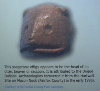
4. Soapstone Effigy closeup
This soapstone effigy appears to be the head of an otter, beaver or raccoon. It is attributed to the Dogue Indians. Archaeologists recovered it from the Hartwell Site on Mason Neck (Fairfax County) in the early 1990s.
Courtesy of the Fairfax County Park Authority
Courtesy of the Fairfax County Park Authority
Credits. This page was last revised on March 29, 2019. It was originally submitted on March 2, 2008, by Kevin W. of Stafford, Virginia. This page has been viewed 1,869 times since then and 25 times this year. Photos: 1, 2, 3, 4, 5. submitted on March 2, 2008, by Kevin W. of Stafford, Virginia.
