Buckland's Station
(On the California Emigrant Trail)
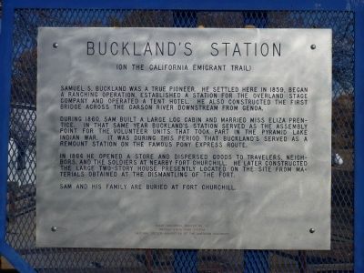
Samuel S. Buckland was a true pioneer. He settled here in 1859, began a ranching operation, established a station for the Overland Stage Company, and operated a tent hotel. He also constructed the first bridge across the Carson River downstream from Genoa.
During 1860, Buckland built a large log cabin and married Miss Eliza Prentice. In that same year, Bucklandís Station served as the assembly point for the volunteer units that took part in the Pyramid Lake War. It was during this period that Bucklandís served as a remount station on the famous Pony Express route.
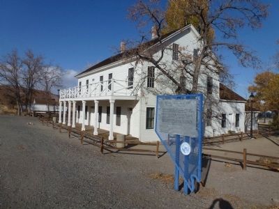
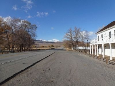
In 1864, Buckland opened a store and dispersed goods to travelers, neighbors, and the soldiers at nearby Fort Churchill. He later constructed the large two-story house, presently located here, from materials obtained at the dismantling of the fort.
Buckland and his family are buried at Fort Churchill.
Erected by State Historic Preservation Office and National Society - Daughters of the American Colonists. (Marker Number 192.)
Topics and series. This historical marker is listed in these topic lists: Agriculture • Industry & Commerce • Roads & Vehicles
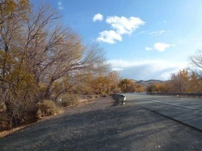
Location. 39° 17.652′ N, 119° 15.096′ W. Marker is near Silver Springs, Nevada, in Lyon County. Marker is on U.S. 95A, on the right when traveling north. Located where Alt US 95 crosses the Carson River. Touch for map. Marker is in this post office area: Silver Springs NV 89429, United States of America. Touch for directions.
Other nearby markers. At least 8 other markers are within 11 miles of this marker, measured as the crow flies. The Longest Ride (within shouting distance of this marker); Bucklands Station Famous Historical Point (within shouting distance of this marker); Crossing Paths (about 300 feet away, measured in a direct line); Stockton Well (approx. 6.7 miles away); Desert Well Station (approx. 7.8 miles away); Mitch "The Buffet" Miller's Copper Queen 1915 Headquarters (CQHQ) (approx. 11.1 miles away); Wabuska (approx. 11.1 miles away); a different marker also named Wabuska (approx. 11.1 miles away). Touch for a list and map of all markers in Silver Springs.
Regarding Buckland's Station. Samuel Buckland settled the valley in 1859 and began
Buckland Station was acquired by State Parks in 1994. The exterior, and the first floor of the interior, has been renovated since the acquisition. An information kiosk outside Buckland Station can direct you to the sites and trails in the area. Buckland Station is located on the Carson River at Weeks Bridge, one-half mile south of the Fort Churchill entrance road.
Source: Fort Churchill State Historic Park
http://parks.nv.gov/parks/fort-churchill-state-historic-park
Credits. This page was last revised on December 22, 2020. It was originally submitted on November 13, 2012, by Chris English of Phoenix, Arizona. This page has been viewed 763 times since then and 56 times this year. Photos: 1, 2, 3, 4, 5, 6. submitted on November 13, 2012, by Chris English of Phoenix, Arizona. • Syd Whittle was the editor who published this page.
