Near St. Michaels in Talbot County, Maryland — The American Northeast (Mid-Atlantic)
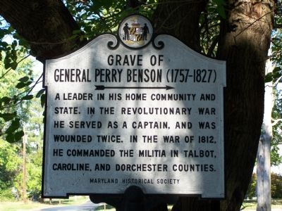
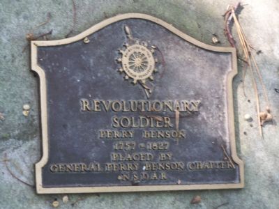
Grave of General Perry Benson (1757-1827)
Inscription.
A leader in his home community and State. In the Revolutionary War he served as a captain, and was wounded twice. In the War of 1812, he commanded the militia in Talbot, Caroline and Dorchester Counties.
Erected by Maryland Historical Society.
Topics. This historical marker is listed in these topic lists: Cemeteries & Burial Sites • Colonial Era • War of 1812 • War, US Revolutionary. A significant historical year for this entry is 1812.
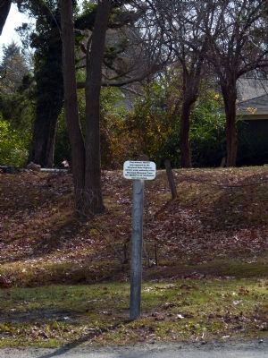
Location. Marker has been reported missing. It was located near 38° 45.122′ N, 76° 10.717′ W. Marker was near St. Michaels, Maryland, in Talbot County. Marker was on Station Road, 0.3 miles south of Maryland Route 33, on the right when traveling north. Touch for map. Marker was in this post office area: Saint Michaels MD 21663, United States of America. Touch for directions.
Other nearby markers. At least 8 other markers are within 4 miles of this location, measured as the crow flies. St. Michaels (approx. 2.9 miles away); Veterans Memorial (approx. 3.2 miles away); This Cannon (approx. 3.2 miles away); Maritime Legend #21663 (approx. 3.2 miles away); Lewis Tarr House (approx. 3.2 miles away); The Miles River (approx. 3.3 miles away); Rebuilding Rosie Parks (approx. 3.3 miles away); Too Much of a Good Thing (approx. 3.3 miles away). Touch for a list and map of all markers in St. Michaels.
Also see . . . General Perry Benson - Find a Grave. (Submitted on October 29, 2007, by Bill Pfingsten of Bel Air, Maryland.)
Credits. This page was last revised on August 19, 2019. It was originally submitted on October 27, 2007, by Bill Pfingsten of Bel Air, Maryland. This page has been viewed 2,134 times since then and 22 times this year. Last updated on November 26, 2012, by Allen C. Browne of Silver Spring, Maryland. Photos: 1. submitted on October 27, 2007, by Bill Pfingsten of Bel Air, Maryland. 2. submitted on November 26, 2012, by Allen C. Browne of Silver Spring, Maryland. 3, 4. submitted on October 27, 2007, by Bill Pfingsten of Bel Air, Maryland.


