Near Sterling in Logan County, Colorado — The American Mountains (Southwest)
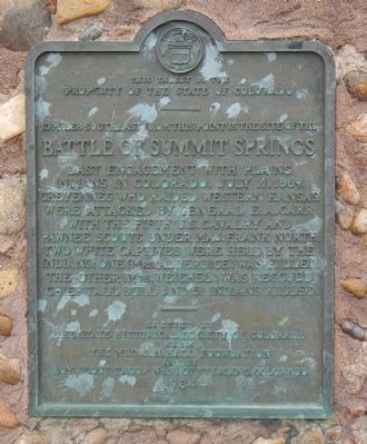
Battle of Summit Springs
3 miles southeast from this point is the site of the
Erected 1934 by State Historical Society of Colorado-J.N. Hall Foundation/Boy Scout Troop No. 36 of Sterling, Colorado. (Marker Number 34.)
Topics and series. This historical marker is listed in these topic lists: Native Americans • Wars, US Indian. In addition, it is included in the Colorado - History Colorado series list. A significant historical date for this entry is July 11, 1871.
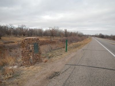
Location. 40° 32.11′ N, 103° 15.979′ W. Marker is near Sterling, Colorado, in Logan County. Marker is on Colorado Route 63 north of County Road 16, on the left when traveling north. Touch for map. Marker is at or near this postal address: 6830 CO-63, Sterling CO 80751, United States of America. Touch for directions.
Other nearby markers. At least 8 other markers are within 8 miles of this marker, measured as the crow flies. William Shaw Hadfield (approx. 3˝ miles away); "Dinkey Engine" (approx. 6.4 miles away); Replica of the Statue of Liberty (approx. 6.8 miles away); Valley Station (approx. 7.3 miles away); Old Sterling (approx. 7.3 miles away); Original Building (approx. 7.3 miles away); The Overland Trail (approx. 7.4 miles away); Indian Wars 1864-1869 (approx. 7.4 miles away). Touch for a list and map of all markers in Sterling.
Also see . . . Battle of Summit Springs. Wikipedia entry. (Submitted on September 12, 2020, by Larry Gertner of New York, New York.)
Credits. This page was last revised on June 16, 2022. It was originally submitted on December 20, 2012, by Barry Swackhamer of Brentwood, California. This page has been viewed 1,957 times since then and 75 times this year. Photos: 1, 2. submitted on December 20, 2012, by Barry Swackhamer of Brentwood, California. • Syd Whittle was the editor who published this page.

