South of Broad in Charleston in Charleston County, South Carolina — The American South (South Atlantic)
The Walled City of Charles Town
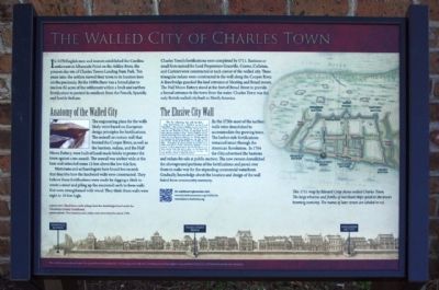
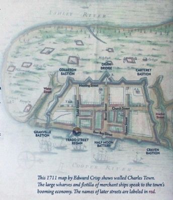
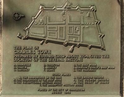
Charles Town's fortifications were completed by 1711. Bastions or small forts were named for Lord Proprietors Granville, Craven Colleton, and Carteret were constructed at each corner of the walled city. Three triangular redans were constructed in the wall along the Cooper River. A drawbridge guarded the land entrance at Meeting and Broad streets. The Half Moon Battery stood at the foot of Broad Street to provide a formal entrance to the town from the water. Charles Town was the only British walled city built in North America.
Anatomy of the Walled City
The engineering plans for the walls likely were based on European design principals for the fortifications. The seawall or curtain wall that fronted the Cooper River, as well as the bastions, redans and the Half Moon Battery, were built of hand-made bricks to protect the town against a sea assault. The seawall was six feet wide at the base and extended some 15 feet above the low tide line.
Historians and archaeologists have found a few records that describe how the landward walls were constructed. They believe these fortifications were made by digging a ditch to create a moat and piling up the excavated earth to form walls that were strengthened with wood. They think these walls were eight to 10 feet high.
The Elusive City Wall
(Advertised sale inset) By the 1730s most of the earthen walls were demolished to accommodate the growing town. The harbor-side fortifications remain intact through the American Revolution. In 1784 the City advertised the bastions and redans for sale at public auction. The new owners demolished the aboveground portions of the fortifications and paved over them to make way for the expanding commercial waterfront. Gradually, knowledge about the location and design of the wall faded from community memory.
(Map included)
This 1711 map by Edward Crisp shows walled Charles Town. The large wharves and flotilla of merchant ships speak to the town's booming economy. The names of later streets are labeled red.
( a QR tag present for additional information - use for modern cellphone and similar devices) Pictures included:Hand-hewed cedar pilings from the drawbridge found under the Charleston County Courthouse and Two bastions and
a redan were advertised for sale in 1784.
Erected 2012 by City of Charleston , its citizens and grant from the Southeastern Archaeological Conference.
Topics. This historical marker is listed in these topic lists: Colonial Era • Settlements & Settlers. A significant historical year for this entry is 1670.
Location. 32° 46.414′ N, 79° 55.634′ W. Marker is in Charleston, South Carolina, in Charleston County. It is in South of Broad. Marker is on U.S. 52, on the right when traveling north. Located beside the Historic Charleston Foundation. Touch for map. Marker is in this post office area: Charleston SC 29401, United States of America. Touch for directions.
Other nearby markers. At least 8 other markers are within walking distance of this marker. Section of parapet, or upper portion of the wall (here, next to this marker); In Search of the Walled City (here, next to this marker); Casper Christian Schutt House (within shouting distance of this marker); The Site of Granville Bastion (within shouting distance of this marker); The Seizure of the Planter (within shouting distance of this marker); Thomas Smith (about 400 feet away, measured in a direct line); 6 Water Street - Francis Saltus House (about 400 feet away); James Verree House (about 500 feet away). Touch for a list and map of all markers in Charleston.
Related markers. Click here for a list of markers that are related to this marker. the
relationship, markers for the bastions mentioned
Photographed By Mike Stroud, December 22, 2012
6. The Walled City of Charles Town
additional marker:
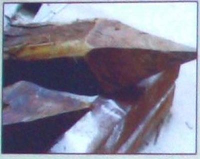
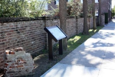
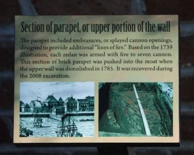
Section of parapet, or upper portion of the wall The parapet included embrasures, or splayed cannon openings,designed to provide additional "lines of fire." Based on the 1739 illustration, each redan was armed with five to seven cannon. This section of brick parapet was pushed into the moat when the upper wall was demolished in 1785. It was recoverd during the 2008 excavation.
Section of parapet, or upper portion of the wall The parapet included embrasures, or splayed cannon openings,designed to provide additional "lines of fire." Based on the 1739 illustration, each redan was armed with five to seven cannon. This section of brick parapet was pushed into the moat when the upper wall was demolished in 1785. It was recoverd during the 2008 excavation.
Credits. This page was last revised on February 16, 2023. It was originally submitted on January 12, 2013, by Mike Stroud of Bluffton, South Carolina. This page has been viewed 3,125 times since then and 642 times this year. Photos: 1, 2, 3, 4, 5, 6, 7. submitted on January 13, 2013, by Mike Stroud of Bluffton, South Carolina.
