
Northeast Kansas City in Jackson County, Missouri — The American Midwest (Upper Plains)
Scarritt Point
Photographed by William Fischer, Jr., February 15, 2013
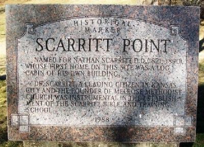
1. Scarritt Point Marker
Named for Nathan Scarritt D.D. (1821-1890), whose first home on this site was a log cabin of his own building.
Dr. Scarritt, a leading citizen in Kansas City and the founder of Melrose Methodist Church, was instrumental in the establishment of the Scarritt Bible and Training School.
Erected 1988.
Topics. This historical marker is listed in these topic lists: Education • Environment • Religion & Religious Structures.
Location. 39° 7.004′ N, 94° 32.584′ W. Marker is in Kansas City, Missouri, in Jackson County. It is in Northeast Kansas City. It is at the intersection of Walrond Avenue and Norledge Avenue, on the right when traveling south on Walrond Avenue. Marker is at Kessler Park. Touch for map. Marker is in this post office area: Kansas City MO 64123, United States of America. Touch for directions.

Regionally, this marker is in the American Midwest, in the Lewis & Clark Corridor, in the Corn Belt, and on the Santa Fe Trail Corridor. Globally, it is in North America, the Western Hemisphere, the Western World, and the Anglosphere. Historically,
this page online
Other nearby markers. At least 8 other markers are within 2 miles of this marker, measured as the crow flies: Gladstone Boulevard Bridge over Anderson Avenue (approx. 0.4 miles away); Founders of Children's Mercy Hospital (approx. 0.4 miles away); Scarritt Point Neighborhood (approx. ¾ mile away); Independence Boulevard (approx. 0.8 miles away); a different marker also named Independence Boulevard (approx. 0.8 miles away); Garrison Field House (approx. 1.4 miles away); Moving Water (approx. 1.4 miles away); Moving Indians, Trappers & Traders (approx. 1.6 miles away). Touch for a list and map of all markers in Kansas City.
Also see . . .
1. Nathan Scarritt, Position of the M. E. Church, South, on the Subject of Slavery (1860). Cornell University Library website entry (Submitted on March 25, 2013, by William Fischer, Jr. of Reynoldsburg, Ohio.)
2. Scarritt College for Christian Workers. Tennessee Encyclopedia website entry (Submitted on March 25, 2013, by William Fischer, Jr. of Reynoldsburg, Ohio.)
via Find A Grave, unknown
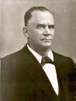
2. Nathan Scarritt D.D. (1821-1890)
"The Rev. Nathan Scarritt: from teacher to preacher to real estate dealer"
Martin City Telegraph website entry
Click for more information.
Martin City Telegraph website entry
Click for more information.
Photographed by William Fischer, Jr., February 15, 2013
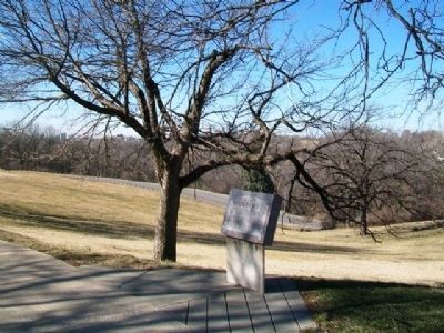
3. Scarritt Point Marker
Photographed by William Fischer, Jr., February 15, 2013
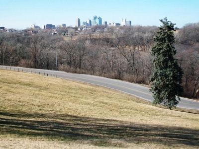
4. View From Near Scarritt Point Marker
Cliff Drive Access Road in foreground
Credits. This page was last revised on June 23, 2026. It was originally submitted on March 25, 2013, by William Fischer, Jr. of Reynoldsburg, Ohio. This page has been viewed 846 times since then and 42 times this year. Photos: 1. submitted on March 25, 2013, by William Fischer, Jr. of Reynoldsburg, Ohio. 2. submitted on May 29, 2022, by Larry Gertner of New York, New York. 3, 4. submitted on March 25, 2013, by William Fischer, Jr. of Reynoldsburg, Ohio.
