Turner's Creek Landing in Kent County, Maryland — The American Northeast (Mid-Atlantic)
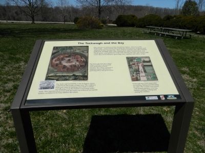
The Tockwogh and the Bay
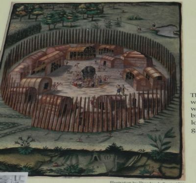
The Tockwogh built their village within a palisade, a tall stockade wall constructed of sturdy branches. The village consisted of longhouse homes, storehouses, gathering places and garden plots.
The Tockwogh traveled by water in dugout canoes crafted from the trunks of large trees. The craftsmen built each canoe by burning a tree trunk's surface and scraping away the charred wood using oyster shells. They repeated the process until the trunk was hollowed out and the bottom was flattened (to help stabilized the canoe).
Tockwogh men were responsible for hunting, fishing and defending the tribe. The women were tasked with tending gardens, weaving baskets, making clothing and raising the children.
Erected by Chesapeake Bay Gateways Network.
Topics. This historical marker is listed in these topic lists: Colonial Era • Native Americans.
Location. 39° 21.267′ N, 75° 59.087′ W. Marker is in Turner's Creek Landing, Maryland, in Kent County. Marker can be reached from Turners Creek Road. Marker is on the grounds of Knock's Folly. Touch for map. Marker is in this post office area: Kennedyville MD 21645, United States of America. Touch for directions.
Other nearby markers. At least 8 other markers are within walking distance of this marker. Captain John Smith on the Sassafras River (here, next to this marker); A Home with a Rich Past (a few steps from this marker); Natural Diversity at Turner's Creek (within shouting distance of this marker); Agricultural Demonstration Area / Historic Tree Grove (about 400 feet away, measured in a direct line); Welcome to the Kent Museum (approx. 0.2 miles away); Turner's Creek (approx. ¼ mile away); Waterfront Hub for Trade (approx. ¼ mile away); Corn Crib (approx. ¼ mile away). Touch for a list and map of all markers in Turner's Creek Landing.
Credits. This page was last revised on June 16, 2016. It was originally submitted on April 12, 2013, by Bill Pfingsten of Bel Air, Maryland. This page has been viewed 867 times since then and 110 times this year. Photos: 1, 2, 3. submitted on April 12, 2013, by Bill Pfingsten of Bel Air, Maryland.


