Near Chippawa in Niagara Region, Ontario — Central Canada (North America)
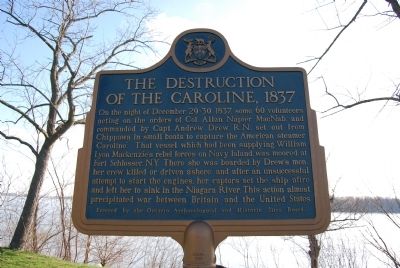
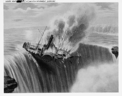
The Destruction of The Caroline, 1837
Erected by Ontario Archaeological and Historic Sites Board.
Topics. This historical marker is listed in this topic list: Waterways & Vessels. A significant historical date for this entry is December 29, 1779.
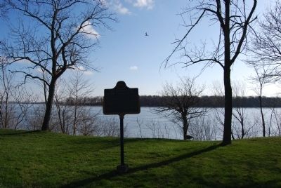
Location. 43° 3.343′ N, 79° 1.583′ W. Marker is near Chippawa, Ontario, in Niagara Region. Marker is at the intersection of Niagara Parkway and Service Road 30, on the right when traveling north on Niagara Parkway. Touch for map. Marker is in this post office area: Chippawa ON L2E 6S6, Canada. Touch for directions.
Other nearby markers. At least 8 other markers are within walking distance of this marker. Niagara River Remedial Action Plan (a few steps from this marker); Chippawa Battlefield Panel 6 (approx. 0.4 kilometers away); Chippawa Battlefield Panel 4 (approx. 0.4 kilometers away); Chippawa Battlefield Panel 5 (approx. 0.4 kilometers away); Chippawa Battlefield Panel 3 (approx. 0.4 kilometers away); Chippawa Battlefield Panel 1 (approx. 0.4 kilometers away); Chippawa Battlefield Panel 2 (approx. 0.4 kilometers away); The Battle of Chippawa (approx. 0.4 kilometers away). Touch for a list and map of all markers in Chippawa.
Also see . . . Wikipedia entry for the Caroline affair. “This action outraged the United States. In retaliation, a group of American and Canadian raiders attacked a British ship and destroyed it. There were several other attacks in 1838 between the British and Americans. The diplomatic crisis was defused by the negotiations that led to the Webster-Ashburton Treaty in 1842, where both the Americans and British admitted to wrongdoing.
“In the aftermath, the incident led to the legal principle of the Caroline test. The principle states that the necessity for self-defense must be ‘instant, overwhelming, and leaving no choice of means, and no moment for deliberation’ ... the Caroline Test remains accepted as part of international law today.” (Submitted on December 29, 2018.)
Credits. This page was last revised on September 27, 2019. It was originally submitted on April 21, 2013, by Mike Wintermantel of Pittsburgh, Pennsylvania. This page has been viewed 861 times since then and 37 times this year. It was the Marker of the Week December 30, 2018. Photos: 1, 2. submitted on April 21, 2013, by Mike Wintermantel of Pittsburgh, Pennsylvania. 3. submitted on April 23, 2013.


