Near Hanoverton in Columbiana County, Ohio — The American Midwest (Great Lakes)
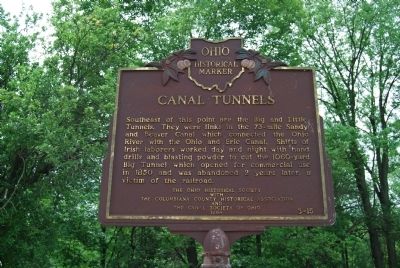
Canal Tunnels
Erected 1964 by Columbiana County Historical Society, The Canal Society of Ohio and The Ohio Historical Society. (Marker Number 3-15.)
Topics and series. This historical marker is listed in this topic list: Waterways & Vessels. In addition, it is included in the Ohio Historical Society / The Ohio History Connection series list. A significant historical year for this entry is 1850.
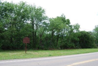
Location. 40° 45.293′ N, 80° 55.039′ W. Marker is near Hanoverton, Ohio, in Columbiana County. Marker is on Lincoln Highway (U.S. 30) 0.7 miles east of Haessly Road, on the right when traveling east. Touch for map. Marker is in this post office area: Hanoverton OH 44423, United States of America. Touch for directions.
Other nearby markers. At least 8 other markers are within walking distance of this marker. Spread Eagle Tavern (approx. 0.9 miles away); Sandy Valley Lodge #408 F & AM (approx. 0.9 miles away); 10166 Plymouth Street (approx. 0.9 miles away); Brick Row (approx. 0.9 miles away); The Lockard House (approx. 0.9 miles away); Presbyterian Church (approx. 0.9 miles away); 10131 Plymouth Street (approx. 0.9 miles away); 10181 Plymouth Street (approx. 0.9 miles away). Touch for a list and map of all markers in Hanoverton.
Credits. This page was last revised on June 16, 2016. It was originally submitted on July 7, 2013, by Mike Wintermantel of Pittsburgh, Pennsylvania. This page has been viewed 966 times since then and 60 times this year. Photos: 1, 2. submitted on July 7, 2013, by Mike Wintermantel of Pittsburgh, Pennsylvania.

